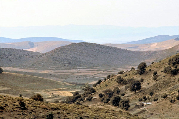
Algeria
Things to Do
El Oued - Touggourt
 |
|||||
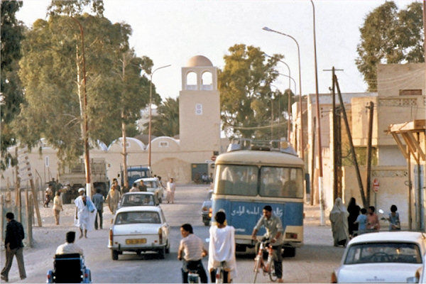
El Oued, also called "Village of a Thousand Domes" is a city and oasis in central-eastern
Algeria with 110,000 inhabitants, north of the Grand Erg Oriental in the Sahara desert.
The economy deals with the products produced in the oasis, especially high-quality dates.
There is also
manufacture of carpets famous for the design with a brown cross, and woven cloth.
It is a very attractive city with large quarters of traditional oasis architecture. Houses have the shape
of cubes and domed roofs, streets are narrow and winding.
Touggourt is a charming Saharan town with buildings made from mud or clay-stone.
The main landmark is a fortress. Mosque and Tmbs of local kings which are placed together under a large dome.
The inhabitants of Touggourt preserve their tribal connections, and are divided into 3 groups:
The Ouled Nail, the Medjara who are Muslims with Jewish ancestry and Rouarha who are
dark skinned Berbers.
Hassi Messaoud - Illizi
 |
|||||
The Name Hassi Messaoud means "the well of Messaoud" in Arabic, named after
Messaoud Rouabeh, a well-digger in the region. Before the discovery of oil in the region,
Hassi Messaoud was not very populated. After discovering oil in the region in the 1950s the French built
two petroleum bases.
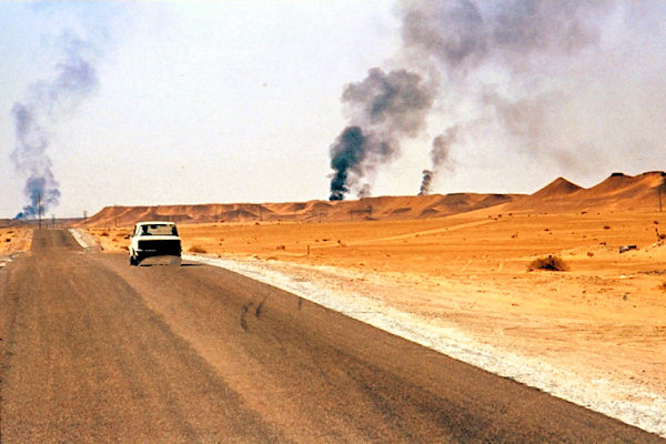
Hassi Messaoud could have been a nice stopover, but is very dominated by the oil industry. At night, the
orange glow from the burn-offs at the oil plants, might be something to interest.you.
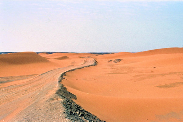
The Grand Erg Oriental is as a matter of fact the second largest continuous sea of sand inside the
Sahara, second to only the Libyan Desert.
Grand Erg Oriental starts almost in the centre of Algeria, and continues well into Tunisia.
 |
|||||
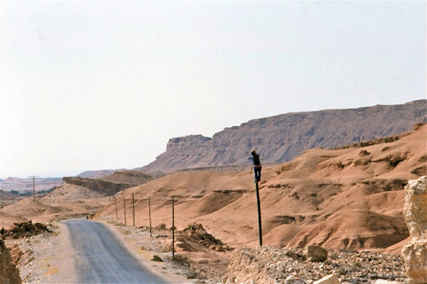
Illizi is a small town near the eastern border off Algeria.
It's hard to get there, course there is only a "Piste"
The first part is getting over the sand-dunes; well you will get stuck, thats for sure.
Getting out off the dunes, there is a huge gravel-area and with some luck jou will find a sign posted,
to show you a way; hopefully to the place you want to go.
So it means you have to take a verry good map and compas; otherwise you can get lost.
There are numerous military forts built across the Sahara (mainly by the French but also by the Italians)
during the last century and a bit.
Ford Issendjel is one off them, near the Libian border
Fort Gardel
 |
|||||
Fort Gardel was built on the track between Djanet and Tamanrassat.
Lt. Gabriel Gardel, led the Ajjer group of the Compagnie Saharienne du Tidikelt, near Ghat,
on 8 April 1913 he won a notable action against a raiding party of vastly superior numbers from the Fezzan.
He was deeply interested in the Tuareg, and his copious notes on the Kel Ajjer were finally edited and
published posthumously in 1961.
He died in that action in 1916 on
the European Front
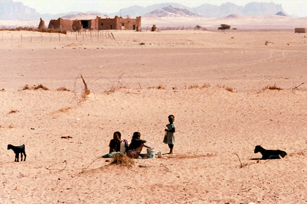
As there is a water-hole; there is a small berber-village nearby the fort.
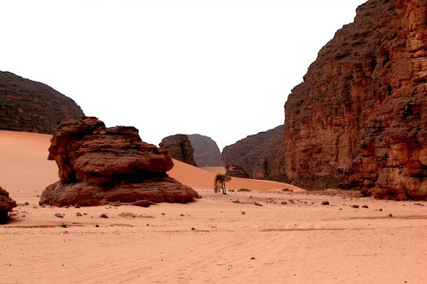
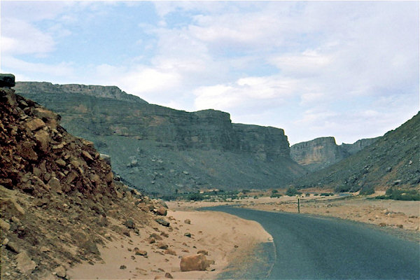
To reach Ford Gardell you have to cross the Tassili N'Ajjer It is one of the more famous landscapes
of Algeria, being a vast plateau, to the north of the Hoggar Mountains.
Few areas of Algeria has wilder landscape than Tassili N'Ajjer, characterised by deep chasms and dramatic cliffs.
Djanet
 |
|||||
Djanet is the main settlement in the southeastern part of Algeria, but is really not what you
would call a town,- there are several villages clustered around the same oasis and palmeraie, none giving
space to very much urbanised buildings and structures.
The Djanet oasis is not a destination that is filled with excitement and wild attractions. Its appeal to
travelers is the beautiful oasis that is lined with palmeries and the peace and tranquility that only such a
desolate area can provide. Most of the local inhabitants of Djanet are Kel Ajjer Taureg, a friendly
and humble community.
Djanet is the place to prepare for excursions to the Rock Paintings of Tassili N'Ajjer, a process that can
be tedious if you insist on not paying any of the inflated prices with the local agencies.
 |
|||||
On the south side off Tassili N'Ajjer; on the way to Djanet, we met some Touareg-women.
It's
hard to get in contact with them, but i managed to get some photographs
What Tassili N'Ajjer is most famous for, are the Rock Paintings, that are up to 8,000 years old.
A large part of these are found in the centre of Tassili N'Ajjer, they depicts a life in the region very much
different from today's Sahara.
The rock paints are of such a quality that they are now protected by the regulations of the Tassili National
Park.
This area can only be entered if you have an official guide with you, or travel with a tour group. These set
out principally from Djanet. Getting a permission to enter appears to be straightforward enough.
 |
|||||
The road between Fort Gardel and Djanet cross the place where the Erg d'Admer meets the
Tassili N'Ajjer.
Hoggar Mountains
 |
|||||
Tamanrasset; city in southern Algeria at an elevation of 1,378 metres in the Hoggar Mountains in
Sahara.
The economic base of Tamanrasset is trade for central Sahara, where it is by far the largest city. There
is some agricultural output from the region as well, of which much is sold at the markets of Tamanrasset: citrus
fruits, peaches, apricots, dates, almonds, figs, cereals and corn.
Tamanrasset is the most isolated of Algeria's larger towns. It has good road connections with urban centres in
the north, and the airport serves most larger national airports.,br>
Algiers lies about 2,000 km north. The southern road leads to the border crossing with Niger (300 km).
The Hoggar Mountains are for many the true highlight of visiting Sahara, but it is too enormous and
too scarcely populated, to allow easy exploration.
It is either done from Tamanrasset or from Djanet, and can be done with 4WD, or at foot.
But it is demanding,
and from Tamanrasset you will not get to see much more than the Assekrem circuit, alone of course extremely rewarding.
 |
|||||
The dominating people of Hoggar are the Tuareg, one of the most "mythical" peoples of Africa,
famous for their blue garments, and for having veiled men, and women enjoying a great deal of freedom.
The Tuareg are counting their family by matrilinear descent.
A sunrise at the top off the Assekrem is one off the must in the Hoggar mountains
,br>
It can only be reached on foot.
Half way through the trip, you will be passing the Eremitage de Pere
Foucauld.
This was built around the hermit Charles de Foucauld in 1910, and is at an altitude of 2,600 metres a
fantastic attraction.
Added to the attraction is that this place is still in use, as a convent, still run by
a handful of Catholic monks.
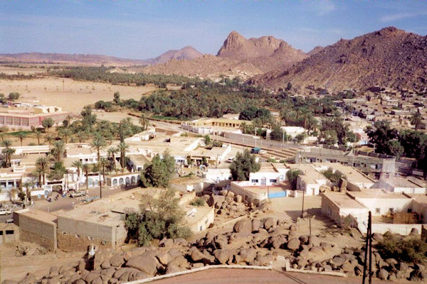
Ain Salah - Ghardaia
 |
|||||
Ain Salah; town and oasis in central Algeria, on the arid Tademat Plateau, at an elevation of
275 metres.
The trans-Saharan caravan routes which used to be of great importance have declined into minimal importance
in modern times.
In Salah is connected with other urban centres by bitumen road. Ghardaia is 800 km north and
the province capital, Tamanrasset, is 710 km southeast.
In Salah is a town on the edge of civilization in several ways. It is under constant threat from encroaching
sand dunes, moving at a speed of 5 metres every year, and houses are covered by it every year but there are
also houses cleared from the sand. Also the water is extremely saline, but is used even for drinking by locals.
Unlike what many people believe, most of Sahara is not soft sand dunes only broken by a thriving oasis with
a little blue lake in the centre.
It is rocks and pebbles for thousands and thousands of miles,- it doesn't make as good photos as the sand dunes,
so therefore less attention.
 |
|||||
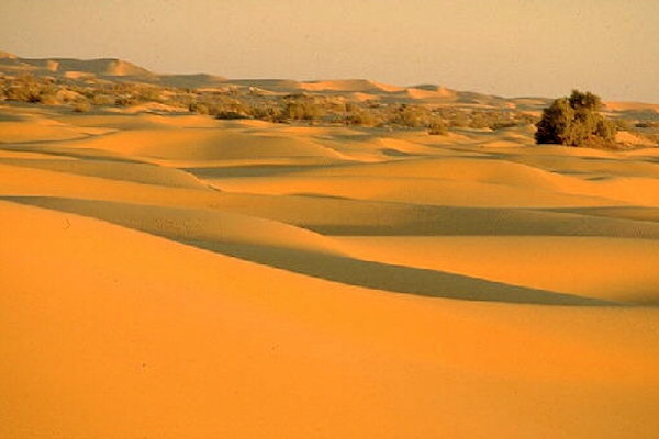
When however, Sahara becomes real endless sand dunes, this is a specific natural phenomenon called erg.
The Grand Erg Occidental is the second largest of the two dominating ergs of Algeria, and as there is
no way any human life could be sustained here, no villages are found inside it, no roads crossing through it.
The experience of it, will be from the fringe, most of the time from a distance, other times it will be
feasible to make long enough walks into it, to really get feeling of solitude and inferiority compared to
the powers of nature.
Ghardaia situated in the M'zab Oasis at an elevation of 526 metres, along the seasonal river
Wadi M'zab.
The city consists of 3 walled sections. The hill-top mosque with its delicate minaret dominates the city.
Houses are simple but attractive in style, in colours either painted white or blue or unpainted brown.
Biskra - Timgad - Batna - Annaba
 |
|||||
Biskra is an oasis of 150.000 date palms producing first class dates.
Exploring the palmeraie, or bathing in the thermal baths are among the more popular things to do for visitors.
The city of Biskra is a charming place, and the market is worth the visit, also for buying your own bags of
fresh fruit and vegetables.
Timgad was constructed as a bastion against the Berbers in the Aures Mountains, by emperor
Trajan in AD 100.
It was originally populated largely by Parthian veterans of the Roman army who were granted lands in return
for years of service.
The city enjoyed a peaceful existence for the first several hundred years and became a center of Christian
activity starting in the 3rd century
In the 5th century, the city was sacked by the Vandals before falling into decline.
In AD 535 the Byzantine general Solomon found the city empty when he came to occupy it.
 |
|||||
The city was built after the best Roman plans, with shops, taverns and craftsmen selling from own stalls,
as well as a forum almost in the centre, and a theatre just south of this.
The area where Timgad lies was earlier a fertile agricultural area, lying 1.000 metres above sea level, with
plenty of water running down from the mountainous hinterland.
But human exploitation has removed trees and soil, and the surroundings of Timgad is presently at the mercy of
Sahara.
Even if Berbers and Arabs each have destroyed Timgad partly, most of the place have been saved by no new
settlements on the spot, as well as sand covering it for centuries.
A lot of Timgad is therefore in perfect
condition.
Some high constructions, like the Theatre and Trajan's Arch still stand. The theatre is used for happenings
even today.
 |
|||||
Batna was constructed by the French in 1844, as a military camp, in order to protect the roads
running into Sahara.
The setting is nice, and with an altitude of 1.038 metres, it is a good refuge in summer.
Annaba, located in the north-eastern corner of the country, on the Mediterranean Sea, and near the
river Wadi Seybouse.
Annaba has very good connections with other urban centres of Algeria by rail or road. There is a also a ferry
connection with Marseilles in France.
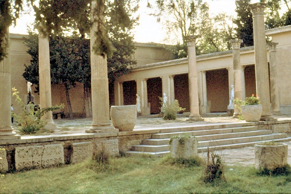
Annaba was a centre of early Christianity, with the Council of Hippo, established in 393 AD.
Augustine was bishop here from 396 AD until 430 AD.