Chile
Things to DO
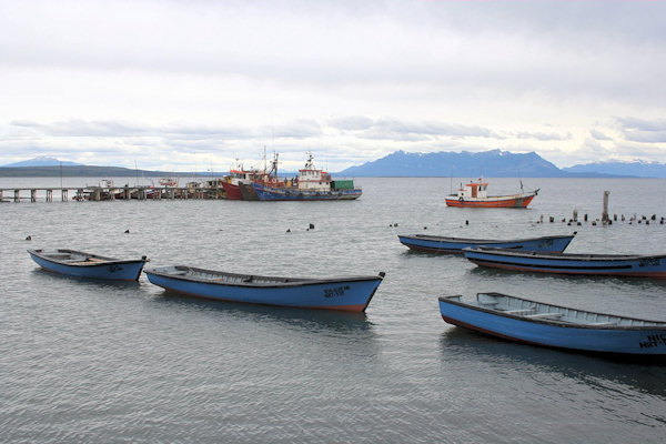
Puerto Natales
 |
|||||
On the shores of Seno Ultima Esperanza (Last Hope Sound), Puerto Natales is the southern terminus of the spectacular
ferry trip through the northern Chilean fjords.
the name Última Esperanza was given by the sailor Juan Ladrilleros, who was seeking the Strait of Magellan
in the year 1557. It was his "last hope" to find the Strait after exploring the maze of channels between the waters of the Pacific
and the mainland.
When the Navimag ferry arrives, disgorging sea-weary backpackers, the town comes alive.
Once depending on sheep and fishing it's now base camp for trekkers heading to Parque Nacional Torres del Paine and has
frequent transport to El Calefate, Argentina.
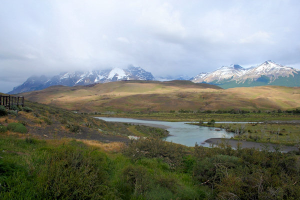
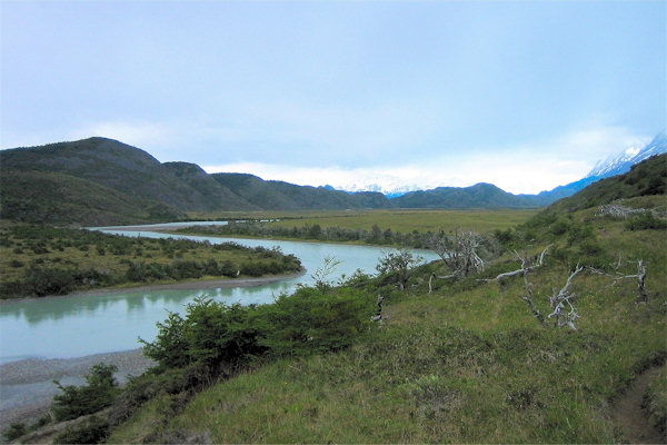
Parque Nacional Torres del Paine
Parque Nacional Torres del Paine lies some 100 km directly north of Puerto Natales in far southern Chile.
Rising up from the flat steppes with breathtaking abruptness; the craggy mountains of Torres del Paine present an astonishing sight
even when viewed from far off on the park's southeastern approach road.
 |
|||||
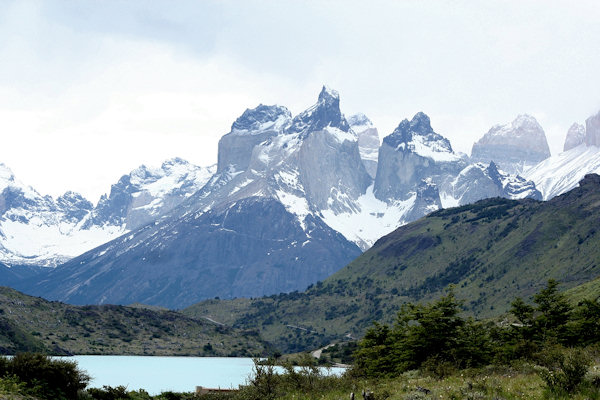
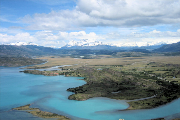
Torres del Paine was landscaped by the great glaciers of the Hielo Sur, which during the recent Pleistocene ice age, extended
right down to cover all but the highest ground and the park's most easterly areas.
Today four major glaciers creep down into the park to terminate in deep meltwater lakes.
Soaring almost vertically more than 2.000 meters above the Patagonian steppe, the Torres del Paine (Towers of Paine) are
spectacular granite pillars that dominate the landscape of what may be South American's finest national park.
The roughly quadrilateral Macizo Piane (Paine Massif) forms the parks core and displays many of it's most spectacular features.
Numerous glacial lakes surround the Macizo Paine.
 |
|||||
Before its creation in 1959, the park was part of a large sheep estancia, and it;s still recovering from nearly a century of
overexploitation of its pastures, forest and wildlife.
Part of Unesco's Biosphere Reserve system since 1978 it shelters flocks of Nandu, Andean Condor, Flamingos and many other species.
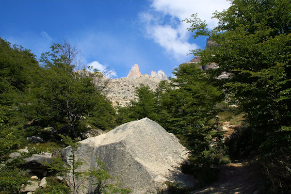
For hikers and trekkers; this 181.000 hectare park is anunequaled destination with well-developed trail network and refugios
and campgrounds at strategic spots.
The weather is changeble (some say you get four seasons in one day), with the strong westerlies that typify Patagonia.
There is no such thing as bad weather, just poor preparations.
Good foul-weather gear is essential; a warm syntetic sleeping bag and wind-resistant tent are imperative for those undertaking
the Paine Circuit and recommended for those doing the extremely popular W; named for the rough approximation to the letter
that it traces out on the map.
Trip 1: Refugio Las Torres to Mirrador Las Torres
Follow the signposted raod uphill past the Hosteria las Torres before dropping down to cross the Rio Ascensio on a
suspension footbridge.
Continue across a small alluvial plain to where the Los Cuernos path diverges left.
From here begin climbing northwestwards up an ancient heath-covered moraine ridge that lends a fine vieuw south across Lago
Sarmiento.
Down to your right, the stream rushes through a gorge of layered black shale.
The path traverses on into the valley along steep slopes high above
 |
|||||
the Rio Ascensio, before moving down to meet the river again opposite Alberque El Chileno, 1 tot 1 1/2 houras from
the Hosteria.
Continue on up the western bank, gradualy rising away from the river.
Crossing several streams on log bridges and stepping stones, the trail brings you up through lovely stands of dwarf lengas
(untouched by the fires that destroyed much of the forest father down the valley) to arrive at Campamento Torres after about
one hour.
This is the main camping area for trekkers and mountaineers in the valley, and has the best and most abundant camp sites in the valley
of the Rio Ascensio.
Take the signposted path from the southern side of the small gully just before you reach the camping area.
Fist follow the tiny clear stream up the left side of te regenerating glacial rubble and then follo the orange paint spots leading
rightwards over bare boulders to arrive at the Torres del Paine Lookout at the top of the morraine wall after 50 minutes.
This often windy spot lies immediately below the Torres del Paine, mighty columns of granite ringed by shelf glaciers whose meltwater
streaks the rocks as it runs into the lake in the foreground - one of the Patagonian Andes' classic scenes.
Return downvalley by the same route.
Trip 2: Lago Pehoe - Lago del Toro
Climb over a monor ridge at the western edge of the grassy plain, beyond the refugia sidling up and down around the mostly steep lakeside to reach a tiny bay opposite some islets after 45 minutes to one hour.
 |
|||||
Rising up dramatically from the brilliantly turquise waters of Lago Pehoe, the black slate and granite summits of the
Cuernos del Paine now appear from a particularly scenic aspect.
Cut souteastwards away from the lake, first over ancient moraine mounds now covered with grasses and light scrub, then across a
broad pampa to meet the broad, cloudy-green Rio Grey.
Following the undulating path downstream along the river's often steep banks, climbing high to avoid cliffs before you drop down to
the riverside te reach Camperamento Las Carnets, a free camping ground in a slight depression.
The route now breakes away from the Rio Grey, turning gradualy eastwards as it crosses a wide expanse of windy steppes.
Where the path brings you to a road, turn left and trek along trails not far to its left to arrive at the administration centre at
Lago del Torro after a final 1 1/2 to 2 1/2 hours.
Trip 3: Lago del Torro - Laguna Verde
 |
|||||
The trip started at the Posada Rio Serrano, from where you have to follow the main road.
After crossing the Rio Paine take the first sign posted trail on the rightside.
The first part of the trail is a steep climb that leads you to the Mirrador los Ciervos with splended vieuws over the planes
and the green Lago del Tore.
It takes about 1 1/2 hour to reach the mirrador.
From there the trail continue relativly flat and within 3 hours you can reach the Hosteria Mirador del Payne.
Punta Arenas
 |
|||||
The Strait of Magellan is a navigable route immediately south of mainland South America. Portuguese explorer Ferdinand Magellan was the first European to “discover” (confirm) the passage during his expedition’s
historic circumnavigation of the world (1519–22); he claimed to have seen such a strait on a chart in the treasury of King
Manuel I of Portugal.
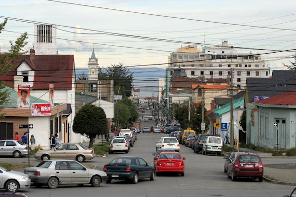
Located on the Brunswick Peninsula north of the Strait of Magellan, Punta Arenas was originally established by
the Chilean government in 1848 as a tiny penal colony to assert sovereignty over the Strait.
Situated astride one of the world's historic trade routes, its prosperity has risen and fallen with that trade.
Punta Arenas enjoyed its first great boom during the California Gold Rush, when it served as a haven for great clipper
ships.
Although the port's importance diminished after the opening of the Panama Canal, the city reached even greater prosperity
early in this century as the center of Chile's international wool trade.
Today, Punto Arenas reflects a great mix of cultures, from English sheep ranchers to Portuguese sailors, and it remains an utterly
fascinating testament to the Chile's rich history.
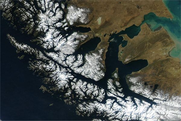
Strait of Magellan
The strait is arguably the most important natural passage between the Pacific and the Atlantic oceans, but it is considered a
difficult route to navigate because of the inhospitable climate and the narrowness of the passage.
![]()
![]()
![]()
![]()
![]()
Tierra del Fuego was considered to be part of a larger, unexplored southern landmass; hence, the strait was the only
transoceanic route mariners could follow.
The first English venture through the passage—in a speedy seventeen days—was that of the privateer and circumnavigator Sir
Francis Drake in 1578.
Exiting into the Pacific, his expedition met fierce winds that pushed his ships south and east to a latitude of about 57° S, where
they were surprised to find open water. (Later, this serendipitous discovery was named the Drake Passage; it offered the possibility
of a more southern route around South America.)