Greenland
Things to DO
Greenland Sea
 |
|||||
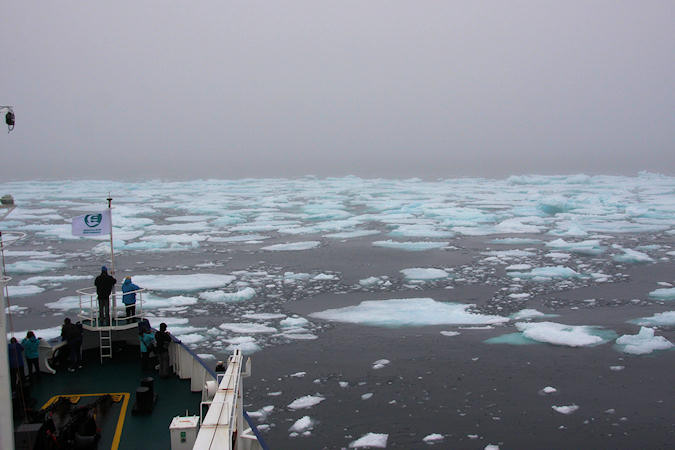
My journey started in Svalbard, where i got on board of the "Plancius", the ship that will
bring me to Estern Greenland an than up to Iceland.
To reach Greenland one have to cross the Greenland Sea. The Greenland Sea is famous for
East Greenland Current
The current is located off the eastern coast of Greenland along the Greenland continental margin. The
current cuts through the Nordic Seas (the Greenland and Norwegian Seas) and through the Denmark
Strait. The current is of major importance because it directly connects the Arctic to the Northern
Atlantic, it is a major contributor to sea ice export out of the Arctic.
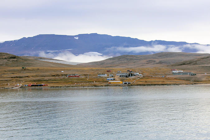
Daneborg
Daneborg is a station in the Northeaster part of Greenland, where the Young Sund reaches
the Greenland Sea.
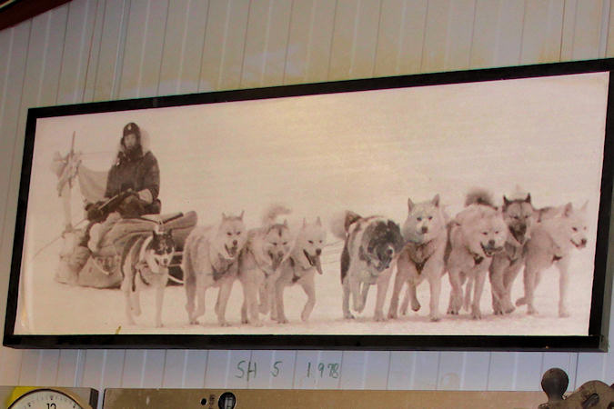
Daneborg serves as the headquarters for the SIRIUS Patrol, the dog sled patrollers of the Northeast
Greenland National Park, with about 975.000 km2 the largest National Park in the world.
 |
|||||
After a political conflict with Norway, in 1933 Denmark gained sovereignty over Greenland from the
International Court in Den Haag. One of the conditions the court demanded was Denmark had to "show its
willingness to own the land, including the uninhabited and inaccessible parts, especially North and
Northeast Greenland"
From 1933 until the end of World War II Denmark was actively patrolling the area but after the war there
was hardly anybody there. This minimal presence of the Danish led to a warning from the International
Court and NATO was expressing its concerns as well. Denmark didn’t want to risk losing its sovereignty
over Greenland and in 1950 the Sirius Sledge Patrol was born.
For four months in the spring and for two months in the fall, 6 sledge teams, consisting of 2 men, 11 dogs
and 1 sledge each, patrol North and North East Greenland. In summer, about 65 depots are laid out by the
patrol itself for the coming winters’ sled journeys. Depot lying is carried out by cutters, planes and
helicopters.
 |
|||||
The unit, then known as the North-East Greenland Sledge Patrol, was activated in the summer of
1941 during World War II to prevent German landings along the northeast coast of Greenland.
At the time, the Germans established a number of secret weather stations on the eastern coast of the island as
this would provide them with invaluable meteorological information both to assist their U-boat campaign and
to predict the weather situation in the European theatre.
Thus the patrol's activities to eliminate these stations and deny Germany such information had significant
implications both for the Battle of the Atlantic in the sea and for air and land fighting in Europe, despite
the enormous distance of Greenland from the main theatres of war.
The patrol discovered the German weather station Holzauge at Hansa Bay on the northeast coast of Sabine
Island, which was subsequently destroyed by USAAF bombers from Iceland.
During the war, the unit suffered one man killed in action. Two others were captured by German forces, but
escaped and rejoined the patrol shortly afterward.
Kejser Franz Joseph Fjord
Kejser Franz Joseph Fjord is a major fjord system in East Greenland, discovered and partially explored by the Second German North Polar Expedition 1869–70 and named Franz Joseph, Emperor of Austria-Hungary, who had made substantial donations to the expedition.
 |
|||||
A magnificent fjord with towering mountains on both sides, its inner reaches choked with huge icebergs,
Franz Joseph fjord is popular with tourists, including cruises from Iceland and Scandinavia.
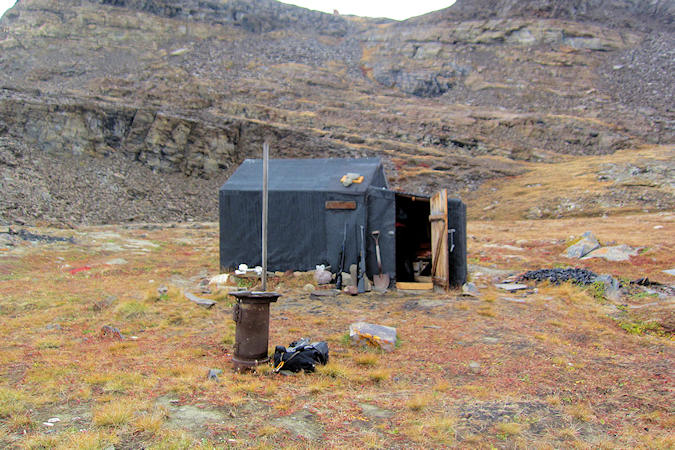
At Antarctic Havn, you can find remains of an early 20th century trapper's cabin.
The trappers lived a hard life. Each winter they skied thousands of kilometres when trapping and controlling
the fox traps. The winter cold could be strong, were the temperatures could fall down to under 50 C.
Their primary target was to catch as many Polar Foxes and Bears as possible and to sell the fur in Norway.
Additionally, down of Eider Ducks were collected and sometimes they also hunted Belugas. Other species such
as Reindeer, Seals and Ptarmigans were mostly taken for local use.
The reason to winter was the fact that only the winter fur brought good profit, whereas the summer fur
was comparatively worthless.
The high arctic northern part of Greenland is in many ways an extreme region. The harshness of
the country is reflected in the birdlife of the area. Few bird species are adapted to cope with this
extreme environment, and, compared with more southern latitudes, only a very
 |
|||||
small number of bird species breed here. A visit in the area during the summer period will certainly
yield observations of the charming Snow Bunting, a passerine species that is distributed all
the way along the east coast of Greenland, even in the most northerly parts.
The Atlantic Walrus is another charismatic mammal found in Northeast Greenland. A large male may weigh
as much as two tons. Their diet consists primarily of shallow-water invertebrates, such as mussels and clamps,
but the Walrus is also known to occasionally hunt seals.
The outer coast is sparsely vegetated with a low, creeping flora of willow and birch together with various
mosses and lichens. The vegetation within the fjord system itself is far more fertile, with Heather,
Mountain Avens and Yellow Saxifrage. The Greenland's national flower, Niviarsiaq, also
known as Broad-leaved Willowherb is found all over the country
Scoresby Sund
Scoresby Sund is an inlet system of the Greenland Sea on the eastern coast of Greenland. It has a
tree-like structure, with a main body approximately 110 km long that branches into a system of fjords
 |
|||||
covering an area of about 38,000 km2
The longest of these extends 340–350 km in from the coastline. The depth is 400–600 m in the main body, but
this increases to up to 1,450 m in the fjords. It is the largest and longest fjord system in the world.
Numerous islands are present. The largest, Milne Land, has an area of 3,913 km² and is located in the
middle of the inlet.
The name honours the English explorer William Scoresby, who in 1822 mapped the fjord area in great
detail.
Numerous islands are present. The largest, Milne Land, has an area of 3,913 km² and is located in the middle
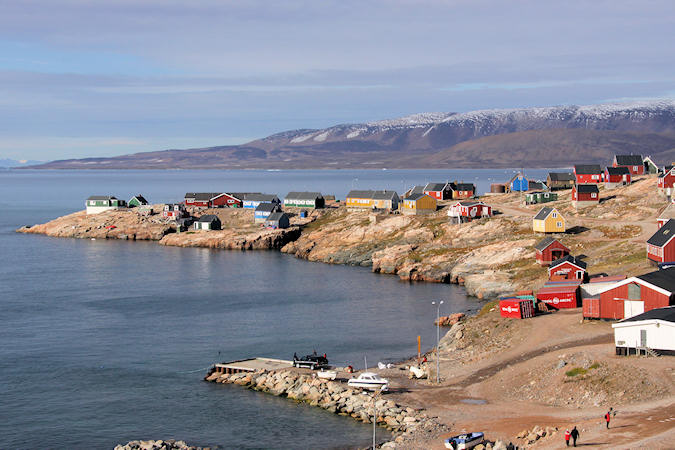
of the inlet. On the northern side of the mouth stands Ittoqqortoormiit, the only permanent settlement
in the region, with a population of about 469 people.
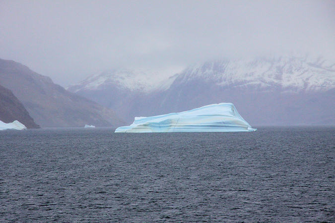
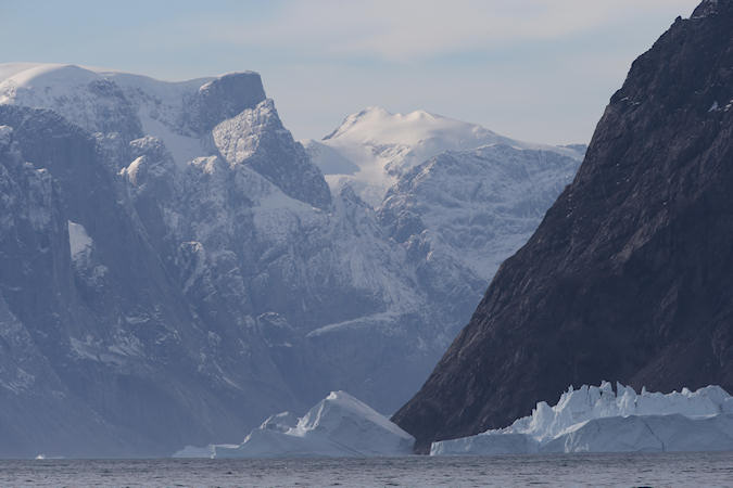
In the Scoresby Sund, we encounter huge icebergs, some over 100m high. Icebergs consist of heavily compacted
snow that fell on the Greenlandic ice cap several thousand years ago - in some cases more
 |
|||||
than 15,000 years ago. The ice cap is in a constant state of change and movement, and every year it
produces thousands of icebergs that are primarily formed in the sea from glaciers in the central and
north-western region of Greenland and on Greenland's east coast.
When an iceberg melts, it makes a fizzing sound called "Bergie Seltzer." This sound is made when
compressed air bubbles trapped in the iceberg pop. The bubbles come from air trapped in snow layers that
later become glacial ice.
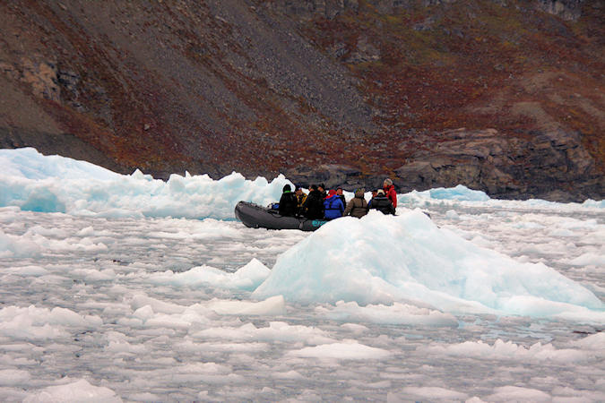
At the south east site of Milne land, the Røde Fjord meets the hudge glacier named Rolige Bræ.
Most of the bergs are grounded as the fjord is only about 400m deep here
We did a zodiac tour here around the icebergs.
 |
|||||
We did also make a landing near Sydkap to view the remains of the Thule Culture
winter houses. As many as 20 people lived in these tiny houses, hunting Greenland Whale and using their
vertebrae to build the houses.
Hunters from Scoresbysund spent long periods here from about 1934, with great success, and a couple of their
houses are found west of the cape.
Muskox are found throughout Northeast Greenland. In contradiction to its’ name, the species is more
closely related to the goat family than to cows.
The Arctic Hare and the Arctic Fox are commonly distributed thoughout Northeast Greenland, and
there is a good chance that visitors to the area will be able to observe both species.
 |
|||||
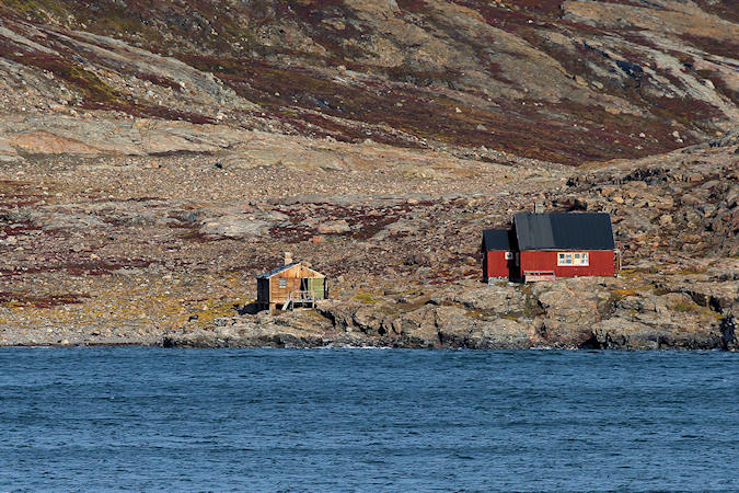
Ittoqqortoormiit:
The Danish name of the town is Scoresbysund, named after the English Whaler, William Scoresby, who was
the first man who mapped this area in 1822.
The town was founded in 1925 on Ejnar Mikkelsens initiative. The foundation was partly a counterbalance
to Norway’s growing interests in Northeast Greenland. But also it was an attempt to create better conditions of
life for inhabitants from Ammassalik, by moving them to a new and in general better area for hunting.
The municipality of Ittoqqortoormiit - the Greenlandic name which means "the place with the big houses"
-is one of the smallest populations in Greenland, but still it is the third biggest municipality area in
Greenland.
The population of Ittoqqortoormiit is Christian (Lutheran). Encouraged by the town’s inhabitants, Ejnar
Mikkelsen started a collection to build a church in Ittoqqortoormiit. Following an announcement in the
Danish press, the Court Official Valdemar Uttendal offered to finance the church. The new church was
finished in the summer of 1928