Greece
Things to DO
Delphi
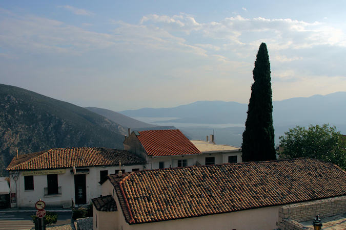
The modern town of Delphi is situated immediately west of the archaeological site of the same name. The town was
created as a home for the population of Castro, which was relocated to allow for the excavation of the site of ancient Delphi.
The town contains extensive facilities supporting the tourist trade at the ancient site. Like the ancient Sacred Precinct, the
town preserves a vertical dimension by terracing the streets and buildings. The streets are narrow, and often one-way.
In addition to the archaeological interest, Delphi attracts tourists visiting the Parnassus Ski Center and the popular coastal
towns of the region.
Agios Nikolaos Church, located in Delphi, is a historic religious site that dates back to the 10th century. The church's
architecture is a unique blend of Byzantine and traditional Greek styles, with its white/Yellow stone walls and red-tiled roof
standing out against the lush green landscape surrounding it. Inside the church, visitors can admire the intricate frescoes that
adorn the walls and ceiling, depicting scenes from the life of Christ and various saints.
 |
|||||
Perhaps Delphi is best known for its oracle, the Pythia, the priestess prophesying from the tripod in the sunken
adyton of the Temple of Apollo. The Pythia was known as a spokesperson for Apollo.
She was a woman of blameless life chosen from the peasants of the area. Alone in an enclosed inner sanctum (Ancient Greek adyton
– "do not enter") she sat on a tripod seat over an opening in the earth (the "chasm"). According to legend, when
Apollo slew Python its body fell into this fissure and fumes arose from its decomposing body. Intoxicated by the vapors, the
sibyl would fall into a trance, allowing Apollo to possess her spirit. In this state she prophesied.
Earlier myths include traditions that Pythia already was the site of an important oracle in the pre-classical Greek world (as early
as 1400 BC). The Pythian priestess emerged pre-eminent by the end of the 7th century BC and continued to be consulted until the late
4th century AD. During this period, the Delphic Oracle was the most prestigious and authoritative oracle among the Greeks, and she
was among the most powerful women of the classical world.
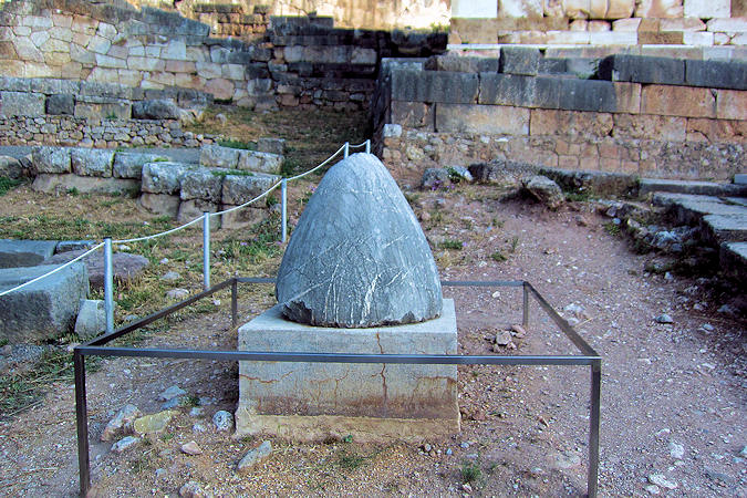
The ancient Greeks considered the centre of the world to be in Delphi, marked by the stone monument known as the Omphalos of
Delphi. According to the Ancient Greek myths, the god Zeus, in his attempt to locate the center of the Earth, launched
two eagles from the two ends of the world. At the point where the two god-sent birds met, Zeus threw down a stone that landed in Delphi.
The original stone is held in the museum of Delphi; there is a simplified copy at the site where it was found.
The Temple of Apollo, god of harmoney, music, light, prophecy and healing, occupied the most important and prominent position
in the Delphi Sanctury. The edifice with the partially restored colonnade visible today is dated to the 4th century BC; it is the third
temple built at the same place.
 |
|||||
According to myth, the foundations of the first temple, dated to the second half of the 7th century BC, were laid by
Apollo himself and its construction was completedby architects Trohonios and Agamedes.
The construction of the second temple was completed in 514-506 BC with funds by the Athenian family of the Alcmaeonids.
It was of Doric order with 6-columned narrow sides and 15-columned long sides. It was made of porous stone, apart from the facade,
which was built of marble from the island of Paros. This temple was destroyed during the strong earthquake of 373 BC.
The later temple of Apollo, visible today, was inaugurated in 330 BC; it is attributed to the architect Spintharos
from Corinth. It was also of Doric order with a peristyle (surrounding colonnade); it was made of coated porous stone.
Its roof and pedimental decoration were made of Panan marble. The temple was destructed under the orders of Theodosius I
in 390 AD
From the entrance of the upper site, continuing up the slope on the Sacred Way almost to the Temple of Apollo, are a large number
of votive statues, and numerous so-called treasuries. These were built by many of the Greek city-states to commemorate victories
and to thank the oracle for her advice, which was thought to have contributed to those victories. The most impressive is the
Athenian Treasury, built to commemorate their victory at the Battle of Marathon in 490 BC.
The Sibyl Rock is a pulpit-like outcrop of rock alomg the Sacred Way. The rock is claimed to be the location from which
a prehistoric Sibyl pre-dating the Pythia of Apollo sat to deliver her prophecies. Other suggestions are that the Pythia might have
stood there, or an acolyte whose function was to deliver the final prophecy. The rock seems ideal for public speaking.
 |
|||||
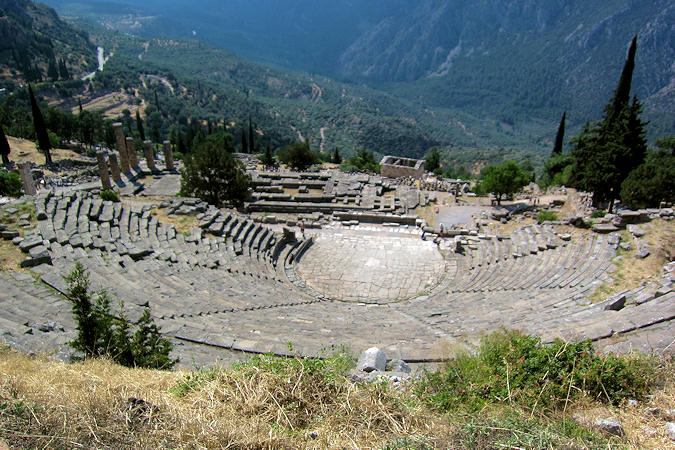
The ancient Theatre at Delphi was built farther up the hill from the Temple of Apollo giving spectators a view of
the entire sanctuary and the valley below. It was originally built in the fourth century BC, but was remodeled on several occasions, particularly in 160/159 BC at the expenses of king Eumenes II of Pergamon and, in 67 AD, on the occasion of emperor Nero's visit.
The Stadium of Delphi hosted the athletic contests of the Pythian religious festival. Initially, in the 5th century BC., a
racing track was formed by leveling the ground; the spectators would sit on the ground. In the 2nd century AD, under the Roman emperor
Hadrian, the Stadium was ameliorated with funds of the wealty Athean Herodes Atticus; the marble seats and the monumental
three-arched entrance visible today were added at that time.
The Castalian Spring, is where all visitors to Delphi — the contestants in the Pythian Games, and especially pilgrims who
came to consult the Delphic Oracle — stopped to wash themselves and quench their thirst; it is also here that the Pythia and the
priests cleansed themselves before the oracle-giving process. The stone fountain was built in the early 6th century BC.
The Gymnasium, a building complex of the 4th century BC, which is half a mile away from the main sanctuary, was a series
of buildings used by the youth of Delphi. The building consisted of two levels: a stoa on the upper level providing open space,
and a palaestra, pool, and baths on lower floor. These pools and baths were said to have magical powers, and imparted the
ability to communicate directly to Apollo.
Kalávryta
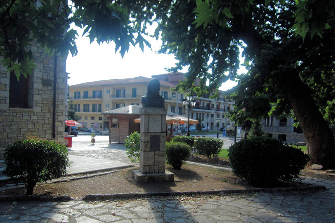
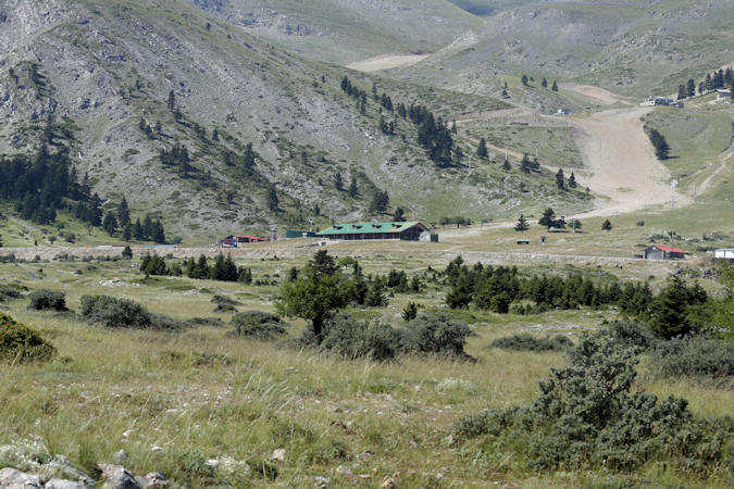
Kalávryta is a Greek mountain town and municipality in the prefecture of Achaea, with a population of approximately 11.000. Kalávryta is situated at an altitude of 750 metres in the valley of the Vouraïkos River, on the northern foothills of the Chelmos Mountains in the Chelmos-Vouraikos National Park.
 |
|||||
During the late Middle Ages, the town was the centre of the Barony of Kalávryta within the Frankish Principality
of Achaea, until it was reconquered by the Byzantines in the 1270s. After that it remained under Byzantine control until
the fall of the Despotate of the Morea to the Ottoman Turks in 1460.
With the exception of a 30-year interlude of Venetian control, the town remained under Turkish rule until the outbreak of the
Greek War of Independence in 1821, in whose early stages Kalávryta figures prominently: it was here that on 21 March 1821
the flag of the revolt was raised at the monastery of Agia Lavra by bishop Germanos III of Old Patras.
Kalávryta experienced the greatest trauma in its history during the Second World War. In the inaccessible mountainous
region of the Peloponnese, resistance to the occupation by Nazi Germany became increasingly fierce and in December 1943 Greek
resistance fighters fought a real battle with the Nazi Troops near Kalávryta, in which 80 German soldiers lost their lives.
Because they suspected the citizens of Kalávryta of having helped the resistance, the Germans invaded the town on 13 December 1943
and massacred the entire male population, 1.430 people aged 15 and over. The clock on the left tower of the cathedral, the Church
of the Dormition of the Virgin Mary, will forever remain at 2:34 am, the time of this mass murder.
 |
|||||
After this massacre, the Nazi executioners locked women and children in the school and set it on fire, after which they also
burned down the entire town. Many women and their children managed to escape by breaking windows. The city was rebuilt and a
museum in the centre commemorates the war crimes. Just outside the city on a hill is a large monument The Place of Execution
with the names of the victims carved into it.
Kalávryta has a Ski Centre which is located east of town, on the slopes of Mount Chelmos.
The town is most famous for Odontotos, the rack railway service (inaugurated in 1896) which covers the 22km Kalávryta – Diakopto route.
The train takes passengers on a tour around Vouraikos Gorge and the route is considered as one of the most scenic in Greece.
The train is now one of the area’s features, in harmony with the surrounding nature. The ride ends at the Corinthian Gulf shores.
Gulf of Corinth
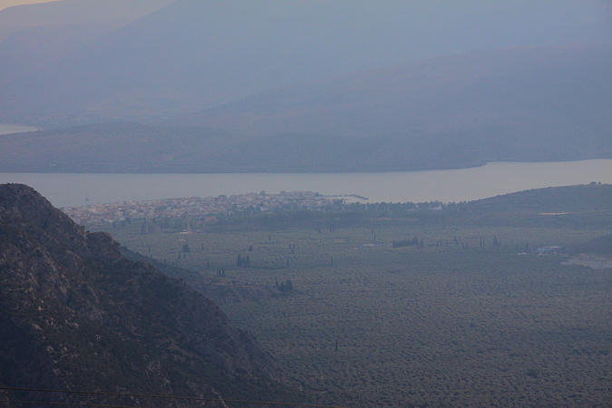
The Gulf of Corinth is a deep inlet of the Ionian Sea, separating the Peloponnese from western mainland Greece. It is bounded in the east by the Isthmus of Corinth which includes the shipping-designed Corinth Canal and in the west by the Rion Strait which widens into the shorter Gulf of Patras (part of the Ionian Sea) and of which the narrowest point is crossed since 2004 by the Rio–Antirrio bridge. A ferry crosses the gulf to link Aigio and Agios Nikolaos, towards the western part of the gulf.
 |
|||||
The Corinth Canal is an artificial canal that connects the Gulf of Corinth in the Ionian Sea with the Saronic Gulf
in the Aegean Sea. It cuts through the narrow Isthmus of Corinth and separates the Peloponnese from the Greek mainland, making
the peninsula an island.
The canal consists of a single channel 8 metres deep, excavated at sea level (thus requiring no locks), measuring 6.343 metres
long by 24,6 metres wide at sea level and 21.3 metres wide at the bottom. The canal is crossed by a railway line, a road and a
motorway at a height of about 45 metres. In 1988, submersible bridges were installed at sea level at each end of the canal,
by the eastern harbour of Isthmia and the western harbour of Poseidonia, providing two additional crossings for road traffic.
The Corinth canal concept originated with Periander of Corinth in the 7th century BC. Daunted by its enormity, he chose
to implement the Diolkos, a land trackway for transporting ships, instead.
Construction of a canal finally began under Roman Emperor Nero in
67 AD, using Jewish prisoners captured during the
First Jewish–Roman War. However, the project ceased shortly after his death.
In subsequent centuries, the idea intrigued figures like Herodes Atticus in the second century and, following their conquest
of the Peloponnese in 1687, the Venetians. Despite their interest, neither of them undertook the construction.
Construction finally recommenced in 1881 but was hampered by geological and financial problems that bankrupted the original builders.
It was completed in 1893, but, due to the canal's narrowness, navigational problems, and periodic closures to repair landslides
from its steep walls, it failed to attract the level of traffic expected by its operators.
Stavroupoli
 |
|||||
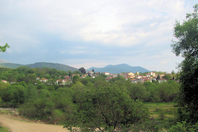
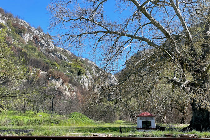
Stavroupoli is the largest and most important of the villages of Nestos river, located on the forested slopes
of Rodhopi mountain range. The village is built on the banks of Nestos River, close to the Nestos Gorge, a top-rated tourist
attraction of Western Thrace.
The Waterfall of Saint Barbara with a height of over 15 meters is situated about 22 km norteast of Stravroupouli. Its water
creates a small lake and the wider area called as the Fracto Forest is know for the rich natural environment including one of the
most important virgin forests in Europe and cultural heritage of ancient Thrace.
The Nestos Gorge, located south of Stavroupoli is where the river has cut deep into the Rhodope Mountains. This natural
passage was exploited in the 19th century and a railway line was built connecting the towns of Toxotes and Stavroupoli. The path
that was built for the construction of the spectacular railway line is now used as a hiking trail.
Alexandroupolis
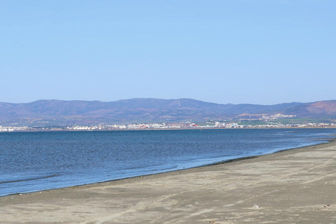
Alexandroupolis is located 15 kilometers from the Turkish border and with approximately 50.000 inhabitants, it is the
largest city in Thrace. Alexandroupolis is a modern city that is growing rapidly, the port and the airport play a very important
role in this development.
This city was only liberated from the Turks in 1919 and was previously called Dede-Agatch, which means "the monk's tree".
After the First World War, the city was assigned to Greece in the Treaty of Neuilly.
In 1920, King Alexander I of Greece visited the city and after that the city was named Alexandroupoli ("Alexander City").
 |
|||||
Approximately on the 12 km east of Alexandroupolis, we find the ruins of ancient Trajanoupolis. The city was founded
by the Emperor Trajan in the 2nd century AD. In the city, there was concentrated a large Greek population from the surrounding
areas and was an important administrative, military and ecclesiastical center of Thrace until the mid of the 14th century.
The most well preserved monumental complex of Trajanoupolis are dated in the Ottoman Period. Among them “Hannah” is
the most impresive one which is a vaulted rectangular building built in the late 14th - early 15th century by Gazi Evrenos Pasa,
which was used as a hostel for travelers and visitors of spas in the region, since it was on the famous Egnatia Road,
connecting Instanbul with Rome. Hannah had a central heating system with hot water.
In the same area there is a complex of Vaulted Baths with tanks of the 16th century.
The newly Greek-orthodox Church of St. Glyceria located near the ancient buildings honors Saint Glyceria who wa born here
in the 2nd century AD.
 |
|||||
The church of Agioi Theodoroi is a distinctive cavern chapel that reminds the peculiar churches of Cappadocia.
Some of the most well-preserved frescoes visualize the Archangel, the Assumption, the Visitation and the Great Prayer.
The church was completed in two phases. The first in the late 11th century called "monastic" and the second in the late 12th and
early 13th century, the so-called "transitional period". The existing murals are typical examples of those periods and styles.
The cave is located near the village of Avanta, 12 kilometers north of Alexandroupolis.
Makri is a small village, with a harbour about 10 km west of Alexandroupolis. Descending from the square to the harbor, a
rugged trail of 300 meters length, leads to the Cave of the Cyclops Polyphemus. The one-eyed giant was the son of Poseidon and
Thoosa in Greek mythology and he first appears in the ninth book of Homer’s Odyssey.