Laos
Things to DO
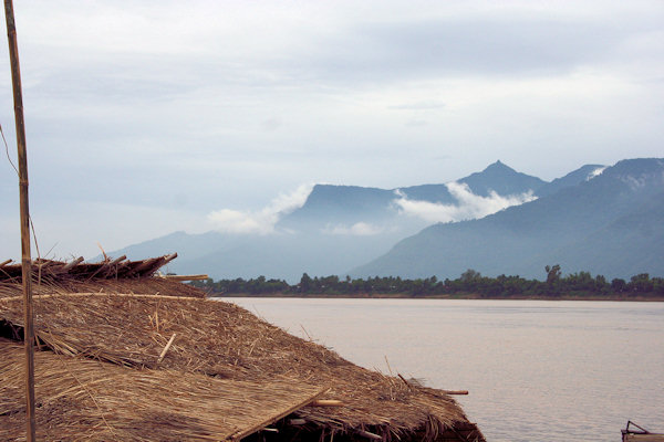
Phu Hin Bun
 |
|||||
The Phu Hin Bun National Protected Area is a huge (1.580 sq km) wilderness area of turquoise streams, monsoon forest
and striking karts topography across central Khammuan.
It was made a protected area in 1993 and it's no overstatement to say this is some of the most breathtaking country in the region.
Passing through on foot or by boat it's hard not to feel awestruck by the very scale of the limestone cliffs that rise almost vertically
for hundreds of metres into the sky.
Flora clings to the cracks in the cliff face, at once wonderfully isolated and desperately exposed.
Although much of the NPA is inaccessible by road, local people have reduced the numbers of key forest-dependent species through
hunting and logging, but there is still enough to see.
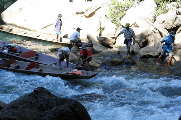
A boat-trip out to Tham Kong Lo will give you a tate of what the protected area has to offer.
 |
|||||
Tham Kong Lo
Imagine a river disappearing at the edge of a monolithic limestone mountain and running 7 km through a pitch-black, winding cave
and you'll start to get an idea of Tham Kong Lo, truly one of the natural wonders of Laos.
Pronounced "thàm kawng láw", the cave-cum-tunnel is quite awesome - up to 100 m wide in some places and almost as high.
It takes a motorised canoe nearly an hour to pass through.
Boat pilots hired for the journey can lead visitors to natural "thâat" (stupas) that are actually groups of glittering
stalagmites in a dry cavern branching off the main tunnel.
Be sure to bring a torch (flashlight) and wear rubber sandals; the gravel in the riverbed is sharp and it's usually necessary
to disembark and wade at several shallow points.
Savannakhet
 |
|||||
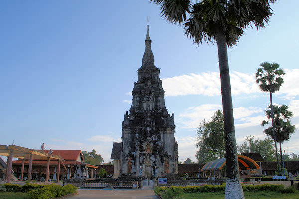
Thought to have been built in the mid-16th century, this well-proportioned, 9m-high "thâat"
is on of the holiest religious edifice in southern Laos.
Built on or near the spot where Chao Fa Ngum's forces were based during the takeover of Muang Sawa in the mid-14th
century, That Ing Hang may occupy an earlier site sacred to the Si Khotabun kingdom.
The Buddha is believed to have stopped here when he was sick during his wanderings back in ancient times. He rested by leaning
("ing") on a hang tree (thus "Ing Hang"). A relic of the Buddha's spine is reputed to be kept inside the "Thâat".
Not including the Mom-inspired cubical base, That Ing Hang was substantially rebuilt during the reign of King Setthathirat
(1548-1571) and now features three terraced bases topped by a traditional Lao stupa and a gold umbrella.
That Ing Hang is about 11,5 km northeast of Savannakhet.
Don Daeng
 |
|||||
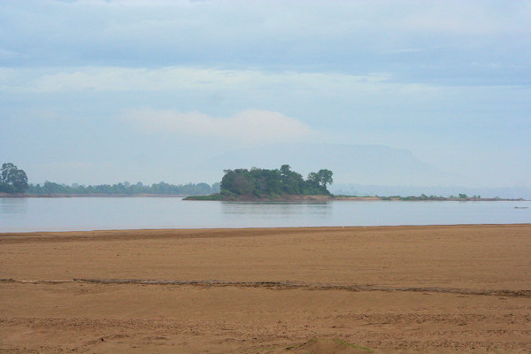
Streched out like an old croc sunning itself in the middle of the Mekong, Don Daeng is a little like an island that time
forgot.
It's classic middle Mekong, with eight villages scattered around its edge and rice fields in the middle.
The small and mostly shaded track that runs around the edge of the 8 km-ling island is mercifully free of cars - bicycles, slow-moving
motorbikes and the old "dok dok" (mini tractor) are all the transport that's required.
The village of Hua Don Daeng, at the northern tip of the island, is where first tourist accommodation has been built. The simple
community guesthouse, with two rooms and mattresses on the floor, makes the perfect base from which to explore the island.
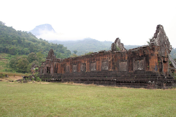
Wat Phu
Wat Phu was initially associated with the city of Shrestapura, which lay on the bank of the Mekong directly east of
mount Lingaparvata ("Linga Mountain.").
By the latter part of the 5th century the city was already the capital of a Kingdom which texts and inscriptions connect with both
Chenla and Champa, and the first structure on the mountain was constructed around this time.
The mountain gained spiritual importance from the linga-shaped protuberance on its summit; the mountain itself was therefore considered
the home of Shiva, and the river as representing the ocean or the Ganges River.
The temple was naturally dedicated to Shiva, while the water from the spring which emerges directly behind the temple was considered
sacred.
Wat Phu was a part of the Khmer empire, centred on Angkor to the southwest, at least as early as the reign of Yashovarman I
in the early 10th century. Shrestapura was superseded by a new city in the Angkorian period, located directly south of the temple.
 |
|||||
In the later period, the original buildings were replaced, re-using some of the stone blocks; the temple now seen was built
primarily during the Koh Ker and Baphuon periods of the 11th century. Minor changes were made during the following two
centuries, before the temple, like most in the empire, was converted to Theravada Buddhist use.
Little restoration work has been done, other than the restoration of boundary posts along the path.
Wat Phou was designated a World Heritage Site in 2001.
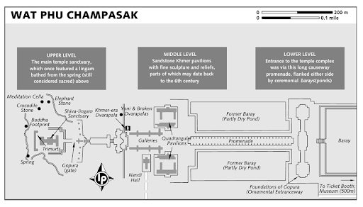
Layout of Wat Phou
Like most Khmer temples, Wat Phou is orientated towards the east. Although the axis actually faces eight degrees south of due east,
being determined primarily by the orientation of the mountain and the river.
Including the barays it stretches 1.4 km east from the source of the spring, at the base of a cliff 100 m up the hill.
 |
|||||
Quadranguler Pavilion
The two palaces stand on a terrace on either side of the axis.
Each consisted of a rectangular courtyard with a corridor and entrance on the side towards the axis, and false doors at the east and
west ends. The courtyards of both buildings have laterite walls; the walls of the northern palace's corridor are also laterite, while
those of the southern palace are sandstone. The northern building is now in better condition.
The palaces are notable chiefly for their pediments and lintels, which are in the early Angkor Wat style.
Over the western pediment of the north pavilion is a relief of Shiva and Parvati sitting on Nandi, Shiva's bull mount.
Nandi Hall
Just behinde the southern pavilion stands a smaller building known as the Nandi Hall From the Nandi Hall an acient road once
lead soth to eventually Angkor Wat in Cambodia
 |
|||||
Dvarapala
Raised about 2m above the first one by a retaining wall, the second terrace forms a landing on the main axis.
This was flanked by two mall structures witch sheltered two Dvarapala (guard of the temple) On of these still stands ramrod
straight with sword held at ready. Both are dated to the 13th century AD.
The Dvarapala has come to be worshipped as King Kammatha, mythical builder of the temple.
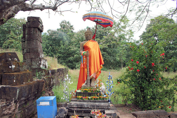
Sanctuary
The sanctuary is in two parts. The front section, of sandstone, is now occupied by four Buddha images, while the brick rear part,
which formerly contained the central linga, is empty.
The entire roof is missing, although a makeshift covering has been added to the front.
Water from the spring which emerges from the cliff about 60 m southwest of the sanctuary was channeled along stone aquaducts into
the rear chamber, continuously bathing the linga.
 |
|||||
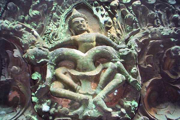
The east side has three doorways: from south to north, their pediments show Krishna defeating the naga Kaliya;
Indra riding Airavata; and Vishnu riding Garuda.
A lintel inside the southern entrance depicts the story of Krishnavatara in which Krishna kills his uncle Kamsa.
Sculped into a large boulder behind the main sanctury is a Kmer-style Trimuti, the Hindu holy trinity of Shiva,
Vishnu and Brahma.
East of the sanctuary a winding path leads to the so-called Crocodile Stone; a boulder with a deep highly stylised carving of
a croc that is believed to date from the Angkor period. Crocodiles were semi-god figures in Kmer culture.
Further along the same path is the Elephant Stone, a hudge boulder bearing the likeness of an elephant thought to date from
the 16th century.
Nearby you can see remains of a stone Meditation Cella.
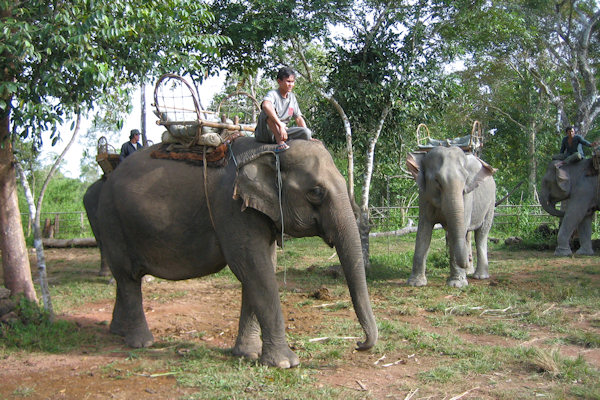
Kiet Ngong
 |
|||||
The elephants have traditionally worked moving logs or doing heavy work in the rice fields. Typically each elephant has a different
owner and in many cases the relationship between owner and pachyderm has existed for the majority of both lives.
But as elephants are expensive to keep and machines now do much of their traditional work, the village has turned to tourism to help
pay their way.
Almost everyone who comes to Kiet Ngong takes the elephant ride to the summit of a hill called Phu Asa, named for a group of
19th-century nationalists who fought against the Siamese.
The flat-topped hill is topped by an expansive archaeological site. Unmortared slate-brick columns, topped by larger slabs, stand
about 2m high and enclose a rectangular space about 180m long and 50m wide.
At the centre of the site is a crumbling and overgrown temple.
Don Khon
 |
|||||
There must be some rule in Laos that says the further south you go the more relaxed it becomes, because just when you thought
your blood pressure couldn't drop any more, you arrive in Si Phan Don. The name literally means "Four Thousand
Islands", and the few you are likely to visit on this scenic 50 km-long strech of the Mekong are so chilled you're liable to
turn into a hammock-bound icicle.
During the rainy season this section of the Mekong fills out to a breadth of 14 km. During the dry months the river recedes and leaves
behind hundreds (or thousands if you count every sand bar) of islands and islets.
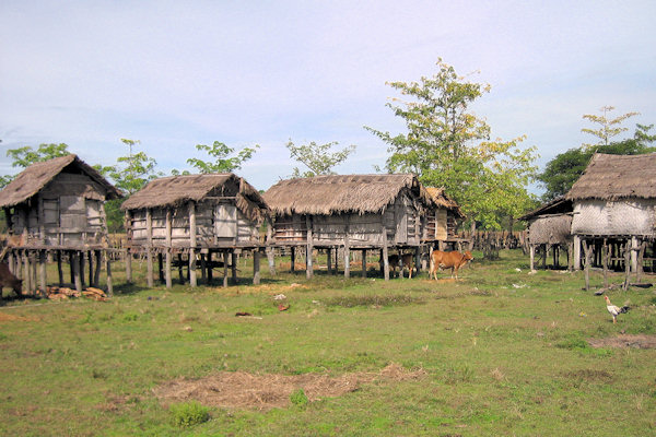
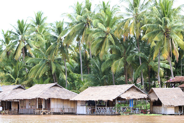
The largest of the permanent islands are inhabited year around and offer fascinating glimpses of tranquil river-oriented village
life.
The islands off Don Det & Don Khon were an important link for supply lines between Saigon and Laos during the French
colonial era.
 |
|||||
In order to bypass the rapid and waterfalls in the Mekong River, the French built a narrow-gauge railway across the
two islands, linked by an attractive arched bridge and terminating in concrete piers at either end.
Small engines pulled cargo across the islands but the French dream of making the Mekong a highway to China never really materialised.
In the main village Ban Khon, there are several crumbling French buildings that are about 100 years old.
Li Phi Falls
About 1.5 km downriver from Ban Khon is a raging set of rapids known as Li Phi Falls.
Li Phi means "trap spirit" and locals believe the falls act as just that - a trap for bad spirits (of deceased people and animals)
as they wash down the river.
The falls can be reached via the main path heading southwest out of Ban Khon. There are plenty of small eat-drink shops at the falls.
 |
|||||
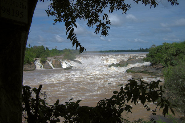
Khon Phapheng Falls
The last part of the Mekong River features a 13km strech of powerful rapids with several sets of cascades. The largest and by far
the most awesome anywhere along the Mekong is Khon Phapheng.
It's a pure unrestrained aggression as millions of litres of water crash over the rocks and into Cambodia every second. Especially when
the Mekong is at full flood this is a spectacular sight and it's probably the most visited site in Laos for Thai tourists, who arrive
here by the busload.
Irrawaddy Dolphin
The Irrawaddy Dolphin is one of the Mekong River's most fascinating creatures, and one its most endangered.
Boats can be chartered from the old French pier at the south end of Don Khon and bring you to a small island that looks over
a deep-water conservation zone. As this is Cambodia you have to pay custom fee (USA $ 1 a person)