Tavan Bogd N.P.
Trekking in The Tavan Bogd National Park
Tavan Bogd National Park
 |
|||||
The Altai Mountains, with eternal snow-capped peaks and glaciers, are the highest of the three
major mountain ranges in Mongolia, straddling the Russian and Chinese frontiers in the Far West.
In this remote region live many nomads of various ethnic minorities. The Kazakhs are Muslims and speak
the ancient Kazakh language. The Tuvans are Buddhist and shamanistic.
Most Kazakhs live in adobe houses in villages in the valleys in the winter and migrate to mountain pastures
in the summer. They have larger yurts than the Mongols. The Kazakhs have also revived the tradition of
hunting small mammals, especially foxes, with Golden Eagles. The Eagle Festival is at the end of
September each year, marking the start of the hunting season (which is a winter time activity).
Tavan Bogd National Park was created as part of an effort to protect some of the last surviving
areas of truly pristine wilderness left in Asia. The park is named after the “five saints”
(tavanbogd) which are in fact the snow-covered peaks of some considerable stature. The five peaks in
questions are Nairamdal (4.082m), Snowchurch (4.071m), Malchin (4.050m),
Cradle (4.113m) and of course the grandest of them all (indeed the highest mountain in Mongolia)
is Khuiten Uul (4.374m).
The peaks form a fitting centrepiece for this relatively new park, they
also mark the border between Mongolia and her neighbours to the west. In fact, Nairamdal’s slopes
straddle the borders of three countries: Russia, China and Mongolia (Nairamdal Uul translates as
“friendship peak”).
Trekking
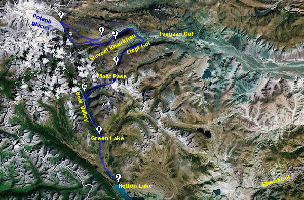
This dramatic journey will bring us to Mongolia’s highest mountain region. We will trek to the Potanii Glacier supported by pack camels and locals. We will then continue across the high Altai and, after passing the Most Pass (3.250 m) trek into the lakes region, next to the Chinese frontier. The total walking distance is 105 km.
Day 1: Öiglii - Camp 1
Day 2: Camp 1 - Camp 2
Day 3: Camp 2 - Camp 3
Day 4: Camp 3 - Camp 4
Day 5: Camp 4 - Camp 5
Day 6: Restday
Day 7: Camp 5 - Camp 6
Day 8: Camp 6 - Camp 7
Day 9: Camp 7 - Öglii
Walking
Distance
-
14,4 km
18,0 Km
24,9 Km
17,3 Km
-
13,5 Km
16,9 Km
-
Altitude
Campside
2.450 m
3.050 m
2.500 m
2.575 m
2.280 m
2.280 m
2.175 m
2.170 m
1.740 m
Day 1
 |
|||||
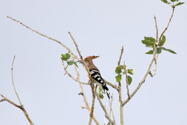
In the early hour’s (around 04:00) I heard 'hoep-oep-oep' shortly after I realised its the
sound of a Hoopoe. Quit a nice looking bird, which is very hard to find in Holland. After
breakfast I heard the sound again, and after grabbing my camera I managed to get a nice picture – a
good start of the day.
At about 10:00 we loaded our luggage in an old Russian 4-wheel drive. These 4-wheel drive vehicles,
featuring air-cooled engines are not the most comfortable but generally preferable in the remote areas
of Mongolia because they can be easily repaired using the tool kits every driver keeps with him.
The road heads west and slightly north passing Ulaanhuis and Tsjengel.
On that way we stopped for some Turkic image stones. These stones, facing east, are sculptured
representations of males. Most are show as warriors, but some seem to represent young men. The size and
quality of Turkic image stones varies considerably. The best show the figure with his right hand holding
a cup in front of his chest and his left hand at the hilt of a sword.
After Tsjengel the road, which gets very poor, leads over desert mountain landscapes, with the snow-capped
Tsambagarav Mountain as a powerful backdrop and the Altai Mountain range ahead of us.
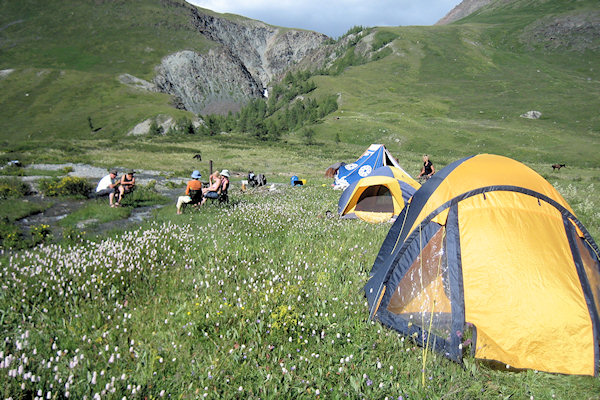
At about 16:00 we arrive at a ger encampment at the Altai Tavanbogd National Park, which houses the park
rangers. Here our guide arranged the permits and all the other necessary paperwork and we built up our
first camp site on the banks of the Tsagaan Gol.
Day 2
 |
|||||
This morning we did meet our crew and pack animals. The crew consists a guide, two woman, who will do
the cooking and 4 Tuvan hunters who will handle the 6 camels and 6 horses. The camels, the two-humped
Bactrian version, generally considered more cooperative than their Arabian counterparts are used to
carry the luggage, tents and cooking equipment. Our crew will use the horses, but the horses will be
available in case one of us can’t handle the walk.
The trek today, climbing gradually through alpine tundra speckled with Edelweiss covers about 14,4 km and
takes us in a gradual slope from about 2.450 m to 3.0500 m
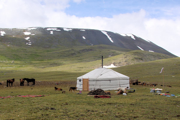
About half way we visited a Tuvan familie. It’s nice to see how the milk there horses and we were invited
into the ger, where the family offered some tea and dried milk/cheese. It was quite omfortable in the ger
and the family had, with the help of solar-energy and a satellite receiver, even a working TV.
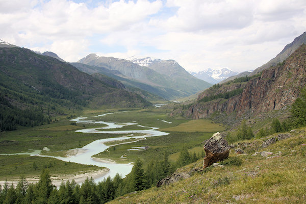
After crossing a grassy ridge, the amazing vista of Tavanbogd, the “Five Saints” opens
before us.
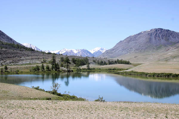
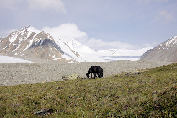
By late afternoon, we did reach our camp in a lush morainal meadow overlooking the 20km long Potanii
glacier – the biggest of the twenty glaciers in Mongolian Altai.
After dinner, when the sun has disappeared, it was getting misty and cold, so we went to our sleeping bags
quite early. Fortunately I had bought a new one, which could get me warm at least –10 C., and I did need it
!!!, as the temperature, inside the tent, did fall down to approximately –4 C.
Day 3
 |
|||||
It was a bright morning, full of sunshine, so the looks at the glacier were great and I managed to
get some nice pictures. Due to the cold night there was ice on the tents and in the surrounding someone
found a icy stream with “ice-flowers”.
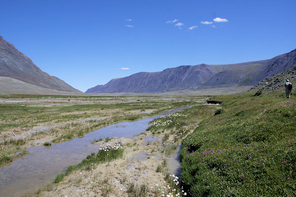
Today we hike back to a camp situated at the foothills of the Shiveet Khairkhan Mountains.
This time it is a gradual descent along Tsagaan Gol which takes its source from the Potanii
glacier.
On the way down, we had some nice views into several valley’s of the icy massif and witness how the
initial stream of glacial dust transforms into the mighty White River.
Walking down the valley I managed to get some very nice pictures of the flowers, butterfly and birds.
Look at
Special Items, when you want to see some of these pictures.
As we continued down the valley, we encountered, again some of the summer camps of the Tuvan families.
During the summer months, Kazakh and Tuvan nomads move from their winter camps up into the higher valleys
in search of good grazing for their animals.
This family has a large flock of sheep and goats, and when we passed the female-members of the family
(incl. the little girls) were busy with the milking process.
Another nice few, was the returning of the husband, with a hudge camel-load of fire-wood, crossing the
river.
Day 4
 |
|||||
Today, we continue our walk, through the heart of the Shiveet Khairkhan Mountains. These are
sacred mountains, and are deeply venerated by local people.
We did encounter numerous examples of the ubiquitous Turkic man-stones known as Balbal. They date
from the 6th to the 8th centuries, and are found in most of the Turkic areas of Central Asia.
Balbal are stones of varying size set up in rows running from west to east on the east side of an Early
Nomadic period burial mound or on the east side of a Turkic enclosure.
Balbal of the Early Nomadic period may be relatively large; their shapes often recall those of Deer
stones.
Balbal of the Turkic period are usually smaller and more numerous: in some cases they may stretch for more
than 200 m to the east. There is no certainty about the meaning of these stones, but they may refer either
to the followers of the person being memorialized or, according to some authorities, to the number of
adversaries killed by that person.
At the junction of the Elegt Gol and Tsagaan Gol valleys we visited some ancient
petroglyphs which date from the second period of the Huns (200 B.C.). Many of them in an amazing
state of preservation considering the extreme weather prevalent in these valleys during the winter
months.
The rough images are etched into the surface of dark, glacier-polished rock. The engraved images depict
wildlife indigenous to the region (although some of the animals represented are no longer found nearby or
have since become extinct), as well as pictures of men on horseback. There’s even a petroglyph representing
a horse-drawn cart, something you will rarely (if ever) see in modern Mongolia.
Day 5
 |
|||||
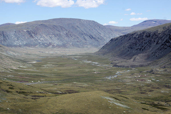
Today, we head up into the heart of Tavanbogd National Park.
The trek begins with a long and challenging trail over the Most Pass (“Icy-pass”). The
first part of the climb follows a swift-moving stream, where the terrain is somewhat boggy and uneven in
places. Continue from here we went up a rocky slope which is completely devoid of vegetation, and
eventually, we reached the glaciated plateau that marks the summit of the pass. Most Pass is approximately
3.250 meters above sea level, and as we started at aboput 2.280 m, it is a 1.000m climbing.
Atop the pass, trek continua’s on the icy-snow for a little more than half an hour. The views of the
surrounding peaks, stretching into China and Kazakhstan, are stunning.
After crossing the pass, a steep descent brings us into a scenic valley which the locals call Bear
Valley.
This region is arguably the most beautiful of the entire trek. Small streams that develop into rivers
originate here. They are fed by melting glaciers which flow down broad steppe valleys. Surrounding the
valley are mountains and forested hills of larch. Along the rivers there are wooded and alluvial meadows
with broad leaf forests.
Day 6
 |
|||||
A rest day;Time to recuperate from the walk, and enjoy the incredible beauty of your surroundings.
After a nice beakfest, and washing some clothes, sitting and reading something, i can boared; time to get
some action.
At the hill-side there is a small waterfall, so i climbed up the slope, to get a better vieuw.
On top were some great veiuws of the surronding, and i've got some nice piture's off different birds,
butterflies and flowers.
At the past days, we did see groundsquirels, but it was hard to get some pictures. But now, course i had
lots of time, after about an hour i got some reasonable pictures.
Day 7
 |
|||||
Today’s walk continues down into the valley passing through pine and larch forests, around lush tarns,
and again through meadows resplendent with wildflowers.
We have to pass a couple of rivers: shoes and the under-part off the zip-trousers had to bee taken of,
course the rivers are to deep. Fortunately these rivers are not to wide (about 10 meters), course the
water is very cold.
At some shade-parts there were even remnants off snow.
As the horses stayed close to us today, there was some time to do some horse riding
At the end off the day we reached the so-called Green Lake, where we set up our camp for the night.
Day 8
 |
|||||
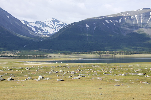
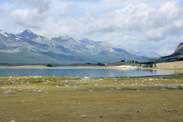
Today, the last day of the trek, we have to walk about 16,9 km, to reach the shores of Hotton
Lake.
After 2 hours of walking, we did climb over a small rise (the remnants of a terminal moraine
of a glacier long since receded) and find ourselfs at the mouth of the gorge.
Before us the valley widens into a great basin, flanked on the west by the nameless snow-covered peaks
which form the border with China.
We are now only 10km from the China border.
These are the summer pastures of numerous Kazakh herdsmen; with hudge herds of yak's.
As reaching the shores of Hoton Lake, means the end of our journey, we say goodbey to the crew,
Who did start their journey back to their homes.
Day 9
 |
|||||
The Russian 4-wheel drive's did arrive yesterday-evening and it will be about 220 km (around 5 hours
driving) to get back to Öglii.
As we started early, there is time to do some walking along the Hotton Lake, where there are some
very nice petroglyphs; depicting some large hors riders.
Passing along the Khovd Gol one of our unbreakable vehicle's got lost, so we stopped at a
Kazakh familie and have to wait for about an hour.
Getting back at Öglii, it was time for getting a beer, looking at the sunset, and look back at one of my
greatest treks.
Mongolia, has proved agian, to be one of the top-five country's of the world.