Svalbard
Things to DO
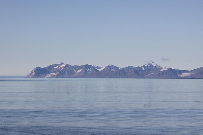
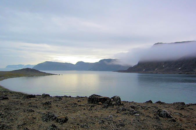
Isfjorden
Isfjorden is the second longest fjord in the Norwegian archipelago of Svalbard. It lies on the west side of Spitsbergen. Around the fjord lie many of the largest settlements in Svalbard: Barentsburg, Longyearbyen (on the Adventfjorden) and Pyramiden.
 |
|||||
Longyearbyen is the largest settlement and the administrative center of Svalbard. As of 2008,
the town had a population of 2.040.
Longyearbyen is a small, compact community, and the centre of Norwegian presence on Svalbard. The Governor
("Sysselmannen") is the highest authority in Svalbard, and the Governor’s office is in Longyearbyen.
Tourism and service industries, education and research are the important industries.
Many visitors are suprised to find a normal town where they expected a pioneer city, instead Longyearbyen has
a well-developed infrastructure which includes kindergartens, a public school, library, museum, church,
hospital, dental service, Post Office, bank, shops, cafés and restaurants, a sports hall with swimming pool
and a cinema. In addition Longyearbyen has a high speed fibre cable connected to mainland Norway, which
insures excellent internet connection.
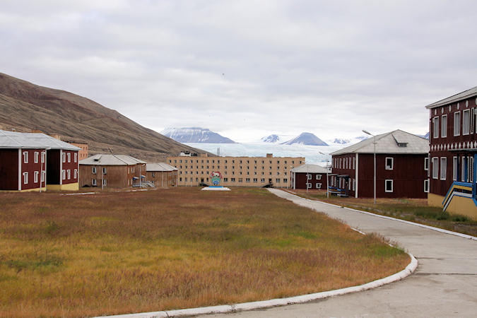
Pyramiden
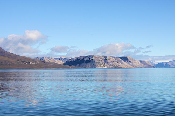
Billefjorden is the central fjord of the three branching from the innermost part of the Isfjorden to the northeast. It is 30km long and 5-8km wide. The fjord is named after the Dutch whaler Cornelius Claeszoon Bille, who is mentioned as being active in 1675.
 |
|||||
Located on its northwestern shore off Billefjorden is the former Russian mining community of Pyramiden
Pyramiden was named after the pyramid-shaped mountain adjacent to the town.
The coal mining settlement was founded by Sweden in 1910 and sold to the Soviet Union in 1927. It is still
owned by the Russian mining company Trust Arktikugol but to keep the town going would cost too much
money so the town was shut down and abandoned in 1998.
The coal deposits are inside the pyramid mountains at several levels. In the 1990s, the mine had a total lengt
off about 60 km. of tunnels in the mountain and 32 openings.
Pyramiden itself, was a compact little place complete with a sports centre, library, hotel and a school.
The centre of the settlement is arranged around the hudge central square, gently rising, with the culture
house at it's top and the Lenin monument still in front of it, lookingdown the square with an impressive
scenic vieuw of the settlement against the hudge white Nordenskiöld Glacier across the bay.
 |
|||||
Though, there are no plans to renovate or re-open the rest of the village, there are around 30 workers
who remain there to help keep preservation of the site.
After the Russian arctic mining company decided to end its activity in Pyramiden, a remarkably abrupt
abandonment left behind a site devoid of humans but still filled with all stuff constituting a modern city -
the books on the library shelves, the sports gear, the glasses in the hotel bar, still lie undisturbed,
preserved by the cold to excite the interest of any traveller who may ultimately stumble upon them. The
world's northernmost grand piano is also located here and is named 'Red October'.
Pyramiden is accessible by boat or snowmobile and visitation is allowed, though going into any of the
buildings unless expressly stated is not allowed. Breaking and entering, vandalism, and theft of items is
accelerating the deterioration of Pyramiden so the Trust Arktikugol has begun to keep many of the buildings
locked.
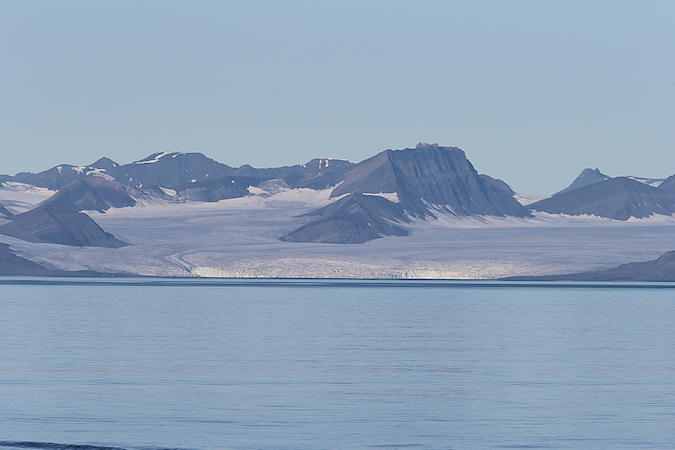
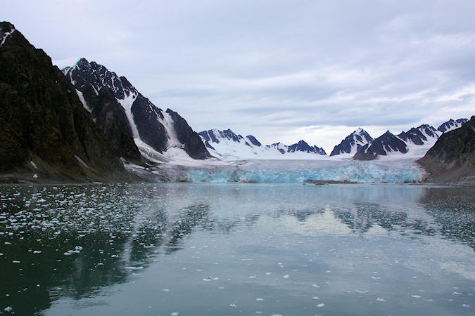
Nordenskiöld Glacier
 |
|||||
A main attraction is the 25 km long and 11 km wide Nordenskiöld Glacier with its ice shapes and
colours and the thunder of original calvings and icebergs drifting away.
The glacier is nammed after professor Baron Nils Adolf Erik Nordenskiöld, 1832-1901. a finnish baron,
botanist, geologist, mineralogist and arctic explorer
Near the glacier, plants are just about to conquer sparsely the fresh moraines with some pioneer species like
the iconic polar poppy or some saxifrages, while a bit further west, denser and more varied tundra vegetation
covers the lower slopes.
Right in front of the glacier, swarms of seabirds (typically kittiwakes and fulmars, plus some glaucous gulls,
guillemots) look for food.
Seals (often curiously coming close to the shore) are a more common sight and often, also polar foxes pay
an inquisitive visit
Nordvesthjørnet
It was here, in the far north-west, that Willem Barentsz and his crew discovered new land on 17
June 1596. They described the land as being “rugged for the most part, and steep, mostly mountains and
jagged peaks, from which we gave it the name of Spitsbergen”.
In the centuries that followed, the large number of Bowhead Whales found here attracted whalers from
the Netherlands and various other countries, and the area became a place of high activity, both on the shore
and in the surrounding sea. This is why Nordvesthjørnet offers the largest concentration of graves, blubber
ovens and other cultural treasures on Spitsbergen, all dating back to this first era of the exploitation of
Svalbard’s natural resources.
 |
|||||
Ytre Norskøya was deemed a good place to be by the British in the early 1600s – years before
the whaling station was built. The area consists of islands and sounds and is therefore ideal to anchor in,
and it also offers shelter from the weather. The open sea is close by.
The whaling station on Ytre Norskøya was one of the really large land-based ones in Svalbard. As many as
nine ovens are lined up along the beach in the bay to the north of Norskøysundet. Some are single ovens, others
are double.
Several sites above and to the west of the ovens are thought to be remains of the provisional structures which
were used to shelter, storage spaces and workshops in the early period. It is also possible to find the remains
of working platforms for carving whale blubber, platforms for cooling vessels and other constructions necessary
for rendering whale oil. With 165 graves, it is one of the largest grave sites in Svalbard.
The biological production in the sea creates a base for many bird cliffs in the area, on which are Arctic Tern,
Atlantic Puffins and Parasitic Jaegers.
Raudfjorden
Raudfjorden is named after a rugged chain of mountains in the west and the red sandstone mountains in the east.
 |
|||||
Polar Bears can be seen in the area all year round, although they thrive more in the spring, when the
food supply is good and the ice conditions are in the fjords in the north, where the ice does not thaw as
quickly.
In the summer, polar bears can still be observed, though only sporadically.
They prey on seals, carrion and seabird eggs. Polar bears also tend to stay close to glacier fronts, because
this is where they are likely to find seals.
There is also a healthy population of Arctic Foxes in the area.
The island Moffen lies just north of 80° so has become a popular target for vessels touring the
archipelago but landing or entering the inner waters is strictly forbidden for fear of disturbing the wildlife
as the island is an important haul-out area for Walrus and a nesting site for birds.
The island was first labelled on a map by Hendrick Doncker, of Amsterdam, in 1655.