Pakistan
Things to DO
Rawalpindi
 |
|||||
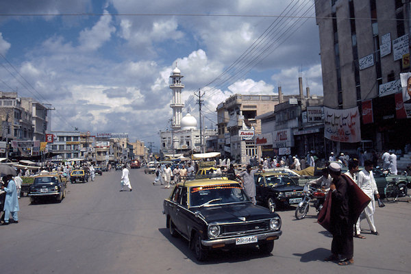
Rawalpindi is one of the oldest settlements along the Kabul-Khyber-Peshawar-Lahore route which, even before the ancient
Silk Trade Route was developed, must have formed a section of the neolithic trade routes that criss-crossed the region of Central Asia,
Persia, Asia Minor and this western part of the Indian subcontinent in 6.000 BC.
During the British campaign to take control of the Khyber Pass and establish their political influence over Afganistan, Rawalpindi
developed as a major military cantonment. Today it is the headquaters of the Pakistan Armed Forces.
Modern buildings that manage to retain a traditional air have sprung up in the more prosperous sections of the city, but it is the bazaars,
with their exotic wares spilling out into the maze of narrow alleys, that make the old city so exciting and fascinating.
It's magic to clip-clop through the swirl of city traffic, missing everything by centimetres, slipping through gaps that are only there for
a split second.
However the old city is changing, with sections of the bazaar being demolished and renovated.
Gilgit
 |
|||||
Gilgit, originally the capital of Bolor and the centre of the Patola dynasty (4th to 8th century AD) and of
Daristan (9th to 10th century AD), was a transit trading centre of the ancient Silk Trade Route.
It was still a slave-trading area until the arrival of the Sikhs and British in the middle of the 19th century and was Buddhist until
around the 17th century when it was invaded by the Shi'ite Muslims from Baltistan.
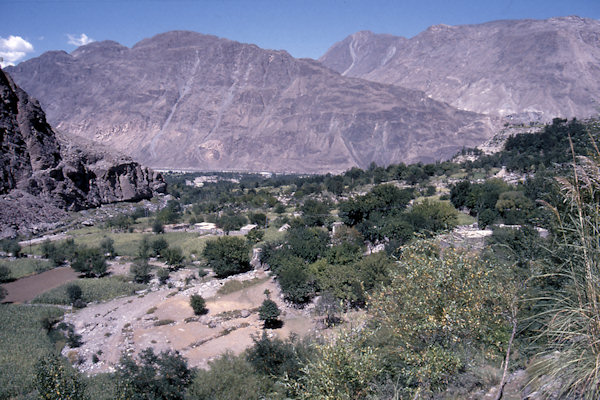
Gilgit is a reasonably quiet, pleasant town through which the river of the same name flows. Spanned by one of the longest suspension
bridges in Asia, the Gilgit river heads south, joining the Hunza river and finally the mighty Indus.
On a rocky cliff in the Kargah Valley, about 9km south of Gilgit is a carving of the Buddha executed during the Tibetan period in
the 7th century AD.
The image is surrounded by the holes for a wooden "image house" structure, which would have sheltered it from the weather.
Karimabad
 |
|||||
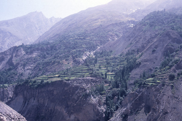
The town nestles on a corner of the Ultar Massif overlooking the Karakoram Highway.
From the highway it is almost straight up, with tiers of flat narrow ledges where villages are stacked one above the other, their
mud-stone huts packed tightly together against the granite flanks of the Ultar.
Over the last six years Karimabad has been gradually transformed into a tourist village with growing bazaars, cafeshotels and banks.
However, despite the progress and modernissation, it has also become more fundamentalist and the woman wear chaddor and the man are
banned from smoking.
A trail east of the village leads to the Altit Fort built in 1503 and the architecture is Kashmiri in design.
It consisis of a number of small rooms and towers and has carved windows, door frames and posts. It is topped by a wooden goat or ibex.
 |
|||||
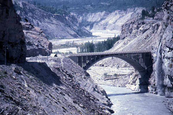
Just south of Karimabad the Ganesh Bridge spans the Hunza River and about 1 km further on top of a hill which is at the
left bank of the river you can find the Sacred Rock of Hunza.
The rock is 30 feet high and 200 yards long and The carvings on the rock dates back to the 1st Millennium AD.
The upper portion of the rock consist of inscriptions which are carved in Sogdian, Kharosthi, Brahmi, Sarada and Proto Sarada languages.
The lower portion is engraved by the images of Ibexes. These ibexes are shown in different situations, including being hunted.
The carvings also contain Horned-Human deities playing with the ibexes.
About 7km south of Karimabad in the Nagar Valley its possible to visit the Bualtar Glacier.
Its a so called black glacier (solid snow mixed with mud) and is supposed to be fastest moving glacier in the world; it moves a
couple of inches per day.
Khunjerab Pass
 |
|||||
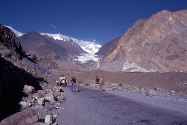
The Karakoram Highway is a 1.300 km national highway which extends from Hasan Abdal in the Punjab province of Pakistan to
the Khunjerab Pass at an elevation of 4.733m, where it crosses the border into China and ends in Kashgar.
Out of Karimabad the route starts zig-zagging upwards, over a distance of about 145 km its climbing more than 2.500 metres up to the
Khunjerab Valley, which is perennially covered with snow.
Khunjerab Valley translates from the Khirghiz as Valley of Blood for this was the area where the Kanjuts of Hunza plundered the
camel caravans.
They were supposed to guard the valley and make it safe for the trade caravans that made their way through here en route to Kahgar or Leh.
They were to collect taxes for their trouble but it appears that this was not enough and they degenerated into plundering the passing caravans.