Suriname
Things to Do
Tapanahony Tour
 |
|||||
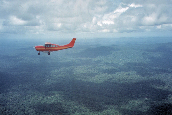
From airport Zorg en Hoop in Paramaribo we fly a domestic flight in about an hour to Drietabbetje.
Arriving in Drietabbetje, the residence of the great chief (Granman) of Aucaners, we made a tour of the village, and
met the Granman to give him a present (a bottle of rum). Overnight we slept in hammocks.
In the morning we depart from Drietabiki to the Amer Indian village Apetina for two days. On the way, we made several stops;
to visit villages, have lunch and go for a swim.
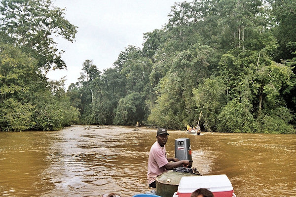
The trip was made in a Dugout Canoe. A dugout is a boat which is basically a hollowed tree trunk.
Construction of a dugout begins with the selection of a log of suitable dimensions. Sufficient wood needed to be removed to make the
vessel relatively light in weight and buoyant, yet still strong enough to support the crew and cargo.
 |
|||||
According to the tradition we stoped at Granborie, the southernmost Maroon village, to inform the village chief about the
purpose of our trip. From tradition (again) we hand over a bottle of rum and he gave us permission to travel further and blessed
our journey.
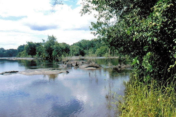
By Korjaal we sail further through the Granborie sula, where an enormous trial of strength between water and rocks takes place.
With our combined forces we managed to drag the boat trough the sula to be able to continue our trip.
At Tutu Kampoe, we meet the first group of Indians. These Indian villages are hard to reach and the inhabitants live almost
entirely self-sufficient.
After passing several other rapids we arrived at the Indian village Apetina (known by the Maroon as Kamalua sula).
 |
|||||
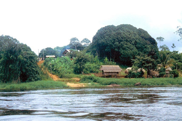
Apetina lies on a low hill along the banks of Tapanahony River and in this village approximately 250 Wayana Indians live in
typical huts on piles.
In Apetina we get a tour to get a good understanding of how the Indians traditionally live here and we had the opportunity buy
some souvenirs that locals offer.
On the trip back to Drietabbetje again we must drag the boat across the Granborie sula and we have some more amazing rapids.
We continue our journey towards the he amazing Granholo rapids
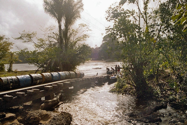
The Granholo falling are not stabbing the boat, so we left the boat and used the step of the Futupasi, where our luggage
could be put on a train cart to get to the other side of the fall this way.
 |
|||||
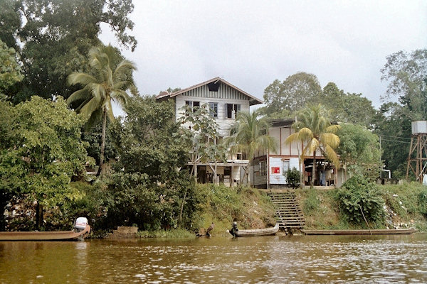
Further downwards, we reached Stoelmanseiland at the point where the Lawa and Tapanahony merge into
the Marowijne river.
The island is named after Dutch lieutenant Stoelman, in the 18th century commander of an army of slaves - the
'Redi Moesoes' - who had been promised freedom if they were willing to help conquer the rebel army of run-away slaves
led by Boni.
Since 1958 the colonial government established a settlement on Stoelmanseiland intended as a regional government centre serving
the Aucaner population living in the area. However, the internal war of 1986 -1989 caused Stoelmanseiland to become depopulated.
Marowijne River tour
 |
|||||
From Stoelmanseiland we continued the tour on the Marowijne River to Albina.
The Marowijne Rivier forming the boundary between French Guiana and Suriname rises on the northern slopes of the Tumuc-Humac
Mountains, near the Brazilian border, and descends generally northward through dense tropical rain forests, to enter the
Atlantic Ocean at Point Galibi.
On the baks off this river there are several village's off the Maroon.
The term Maroon was generalized to include any slave or group of slaves that had rebelled or escaped from their owners frequently
within the first generation of their arrival from Africa, often preserving their African languages and many of their cultural traits.
In the Guianas they were commonly known as Djukas or Bush Negroes.
Many African traditions have been preserved among the various Maroon communities.
 |
|||||
Langatabbetje is part of the territory of the Paramaccans, a Marron tribe that was formed in the 18th century by
runaway slaves from plantations along the Commewijne and Cottica rivers.
It is also the residence of their chief or 'granman.'
Small-scale gold mining is one of the main sectors of the economy of Suriname. On the Marowijne river you can find some
floatable gold dredges.
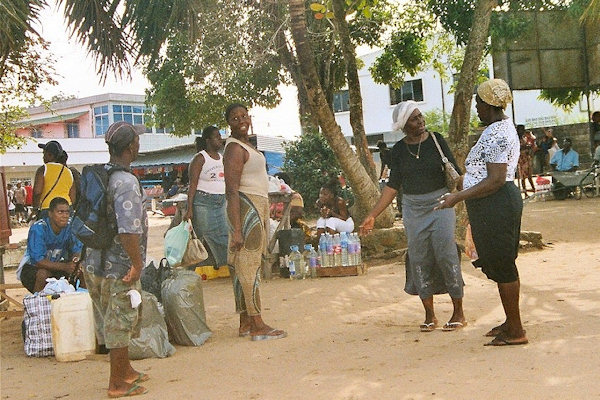
Albina is a town in eastern Suriname, and is capital of the Marowijne District.
The town lies on the west bank of the Marowijne river, directly opposite the French Guianan town of Saint-Laurent-du-Maroni,
to which it is connected by a frequent ferry service.
 |
|||||
The Galibi nature reserve is situated in the northeast corner of Suriname, at the mouth of the Marowijne river.
This area is aproximize 4.000 ha in size, 13 km long and 1km wide.
The reserve was established to protect the sea turtles that use the beaches of Galibi as their breeding ground.
Furthermore controlled ecotourism at Galibi is allowed, so people can see how beautiful yet also vulnerable sea turtles are.
The Galibi reserve and the nearby Amerindian villages are accessible only by boat, about 1 ½ hours downstream from Albina.
Brownsberg Nature park
 |
|||||
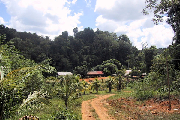
At approximately 130 km south of Paramaribo, and also North West of the Van Blommenstein lake, lies the more or
less 6.000 ha large Brownsberg Nature park.
Brownsberg is called after John Brown, a well known gold miner at the end of the 19th century.
From the 500 meters high plateau of the Brownsberg one can enjoy the magnificent views of the Brokopondo Lake and
the vast Tropical forest stretching out in all directions.
Overtime little creeks have cut their way through the mountain forming beautiful waterfalls along the cliffs.
These waterfalls are accessible via hiking trails through the jungle.
During the trip to the Brownsberg there is a rich diversity of flora and fauna. From centimeters small palm trees to
meters high trees with orchids. In the wild, there is a wide variety of animals. From snakes to frogs to monkeys and pigs.
For nature lovers is Brownsnberg highly recommended.