Iceland
Things to DO
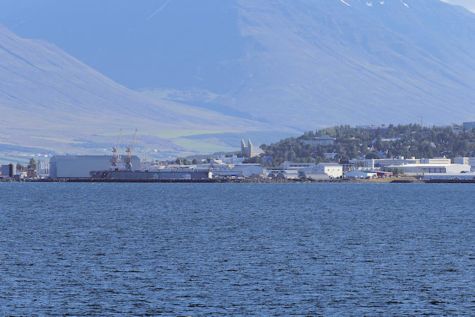
Akureyri
 |
|||||
Akureyri was first mentioned in 1562, when a sentence was passed on a woman who had bedded a man
without being in possession of a marriage certificate. This was when the only buildings in Akureyri were the
shops and storehouses of Danish merchants. It was not until 216 years later, in 1778, that the first residential
house was built in Akureyri and only 8 years after that Akureyri became a certified trading post for the first
time in its history, as part of measures taken by the Danish king to improve living conditions in Iceland.
On 29 August 1862 Akureyri received the status of a township, with 294 inhabitants
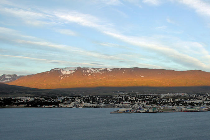
Akureyri now is the second largest urban area after the capital area of Reykjavík, with a population of about
18.000. Akureyri is the centre of trade and services in northern Iceland.
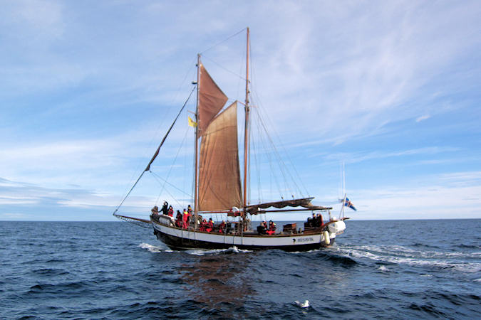
The port of Akureyri is vital to the town, which largely bases its livelihood on fisheries. It is the site of
large fish processing plants and has docking facilities for trawlers. The ice-free nature of the port is also
important for freight handling and for tourism, as cruise ships stop in Akureyri during the summer months.
 |
|||||
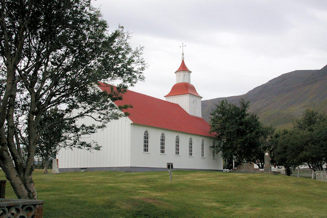
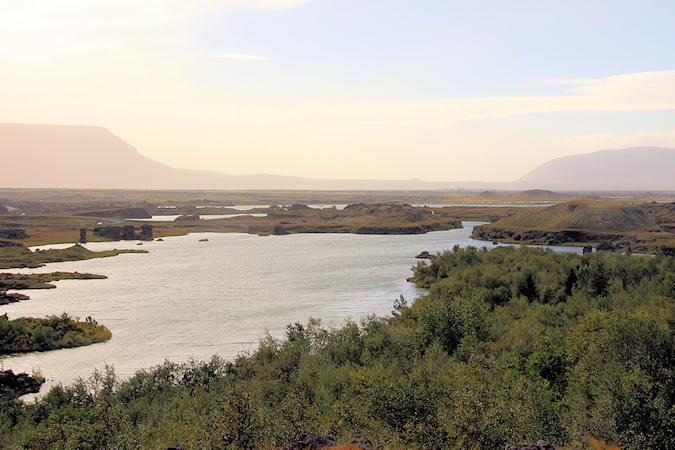
From the settlement of Iceland, around 1000, Möðruvellir, about 15 km north off Akureyri was a
prosperous farm and in 1296 a Augustinian monastry was established which lasted until the reformation in 1550.
The church, rebuilt in 1865 after a fire, was at that time one of the largest in the country.
Hjalteyri is a small village on the western shores of Eyjafjörður, about 35 km nort of Akureyri. The
first houses where built around 1870 and it became an authorized trading post in the year 1897. During the
"herring years" Hjalteyri had one of the biggest harbour for herring boats and in 1937
Kveldulfur Ltd built at Hjalteyri the biggest herreing meal factory in the world. The herring disappeared
in the 1960's and the factory was closed down.
During world war II the British army used Hjalteyri as alook out point for their enemies ships and submarines.
Today Hjalteyri is a harbour for small fishing boats and the old factory regularly holds art exhibitions.
 |
|||||
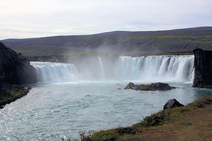
Goðafoss is one of the most impressive waterfalls of the country. It is situated in the 175 km long
glacial river Skjálfandafljót just 40 km east from Akureyri. The water of the river Skjálfandafljót falls from
a height of 12 meters over a width of 30 meters.
According to the Saga of Christianity the formerly Pagan chieftain Thorgeir threw the wooden images of
the pagan gods into the waterfall after Christianity had been accepted in the Parliamentary Plains in the year
1000. The name of the waterfall, The Waterfall of the Gods, is derived from this event.
The chieftain Thorgeir played the most important role in the Christianisation of Iceland. After extended
disputes and the danger of a bloody battle between the Pagans and the Christians it was left up to him to
decide which religion should become the religion of the state.
Húsavík
 |
|||||
Húsavík has in recent years become increasingly popular as a destination for both foreign and
native visitors.
There are several reasons why visitors flock to Húsavík. It is the largest town and centre of commerce and
services in Þingeyjarsýsla county of Northeast Iceland and offers all basic services in addition to a variety
of recreational opportunities.
Húsavík is a clean and tidy town whose heart beats around the harbour with its remarkable Whale Museum.
What had once been an abandoned slaughterhouse in town is now one of the most visited places in the north of
Iceland, providing 1.600m2 to display whale skeletons of several species and fascinating facts about the
whales.
The church, built in 1907, stands beside the main street and is regarded as an emblem of the town. Up the
street is the museum building with its collection of museums; a regional museum, district archives, museum
of natural history, maritime museum and photograph and film archives.
Húsavík harbour lies below the bank right in the heart of town. The harbour once boasted a large
fishing fleet, bustling with the activity of fishermen. It still serves as a fishing harbour but today’s
activity revolves more around the successful whale watching businesses.
 |
|||||
The first organized whale watching excursions in Iceland started from here in 1995. Since then, whale watching
has become a major attraction and Húsavík continues to be the leading destination for whale watching.
In the beginning the Minke Wale was the most common whale in Skjáflandi Bay but in the last
years more species are frequently seen.
For instance the Humpback Whale, certainly one of the most popular whales as it normally raises the
fluke before deep diving and occasionally waves the gigantic flippers or breaches from time to time.
The bay is also a great destination because of the birdlife and scenery. There are two islands in the bay,
Lundey (Puffin Island) and Flatey (Flat Island), where a lot of birds nest.
Therefore the birdlife is colourful, Puffins, Actic Terns, Guillemots, Gannets,
Northern Fulmar and more are frequently seen during the tours.
Lake Myvatn
Lake Myvatn is the country's fourth largest natural lake. It abounds in lake char and is netted by
the farmers during summer and ice fishing is practiced in winter. The lake area is known world wide for its
exceptionally many breeding duck species (15-16) and the abundance of other avifauna.
The lake's surroundings show such variety in landscapes and amazing geological formations, that the visitors
have to spend several days there to enjoy them fully.
 |
|||||
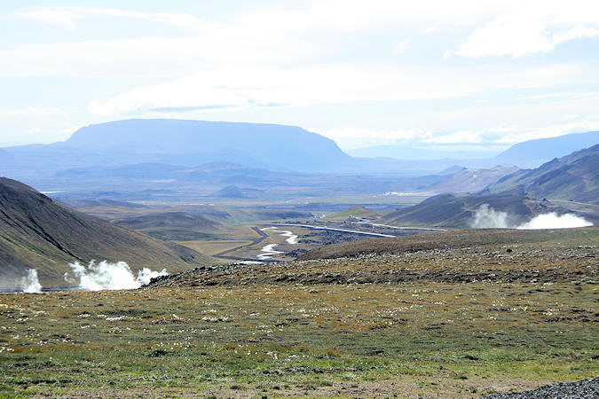
This area is extremely volcanic. Nine eruptions took place there during the period 1975-1984 and the
continental drift was measured 4.8 m. This show of nature's immense power gave the scientist the first real
opportunity to study the plate tectonics on dry land.
On and around the lake there is a teeming and varied birdlife, and Mývatn is the habitat of many kinds of lake
and marsh birds. However, much of Mývatn’s fame is due to the fact that, during summer, there are more
different species of duck gathered on and around the lake than anywhere else in the world.
Skútustaðagígar pseudo craters were formed by gas explosions when boiling lava flowed over the wetlands.
The craters are a popular site for birdwatchers and are protected as a natural wetlands conservation area.
The name of Mt. Krafla was extended over the high temperature area after the geothermal power station
was built in 1974.
The average depth of the boreholes feeding the power station is 2000 m. They are lined with pipes down to
700 - 1000 m to prevent collapsing. The steam pressure from the separators in the grey building
 |
|||||
equals 7,7 bars when it is pipelined to the generators in the red building.
The output is about 70 MW and the power station is directly connected to the national grid.
Because of the latest Myvatn Fires, 1975 - 1984, and the consequent plate tectonics the boreholes caved
in and prevented the operation of the power station until 1979.
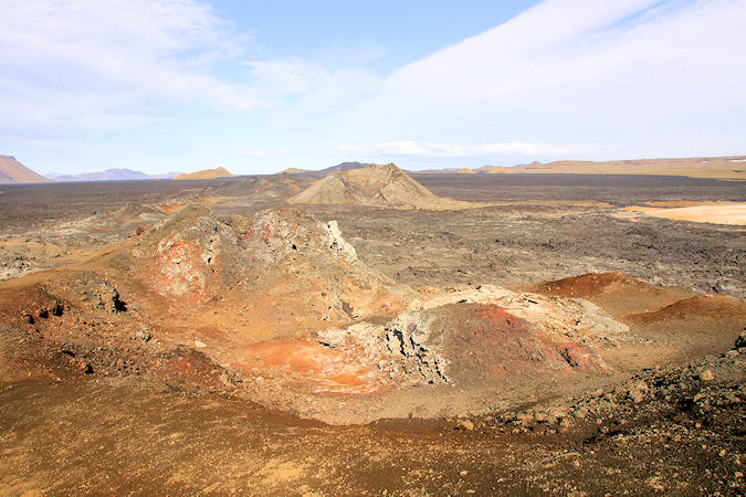
Krafla’s most impressive, and potentially most dangerous, attraction is the Leirhnjúkur Crater and its
solfataras, which originally appeared in 1727.
It started out as a lava fountain and spouted molten material for two years before subsiding. After a minor
burp in 1746, it became the menacing sulphur-encrusted mudhole that tourists love today.
From the rim above Leirhnjúkur you can look out across the Krafla caldera and the layers of lava that bisect
it. The first of these lava flows was from the original Mývatnseldar, which was overlaid in places by
lava from the 1975 eruptions, and again by 1984 lava.
 |
|||||
The earth’s crust here is extremely thin and in places the ground is ferociously hot. Steaming vents on
the rhyolite mountain to the west are the last vestiges of a series of explosions in 1975, when the small
grass-filled crater on the western slope of the mountain south of Leirhnjúkur erupted as Kröflueldar,
a continuation of Mývatnseldar.
A well-defined track leads northwest to Leirhnjúkur from the Krafla parking area; with all the volcanic
activity, high temperatures, bubbling mudpots and steaming vents, you’d be well advised not to stray from
the marked paths.
Víti is a huge explosion crater, about 300 metres in diameter. The crater was formed during a massive
volcanic eruption at the start of the famous Mývatn Fires in 1724. The eruption continued more or less
non-stop for 5 years and Víti’s bubbling cauldron of mud boiled for more than a century after that.
Víti is situated near Krafla and there is a tarmacked road leading up to it from highway 1.
 |
|||||
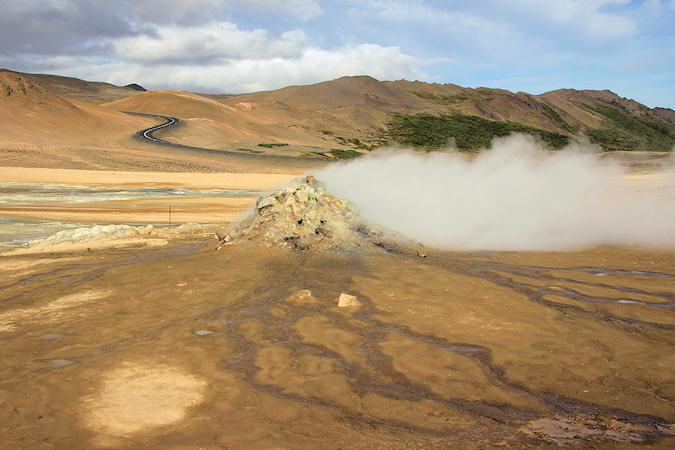
The pass Námaskarð is strategically located at a short distance from the Krafla volcano
system.
Námaskarð earns its notoriety chiefly because of its sulphurous mud springs called Solfataras and
steam springs called Fumaroles. Though you will scarcely find any pure water spring in this wonderful
geothermal site of Iceland, the beauty of the colorful minerals defies all comparisons.
The gigantic size of the mud craters is what makes you go ‘wow’ at the sight of them.
The other thing that is sure to strike you about Námaskarð is the sheer lack of vegetation. However, if you
give a thought to the high temperature range, it does not appear an impossibility altogether. The constant
emission of the fumes has made the ground utterly sterile and acidic, unfit to sustain any floras and faunas.
You must bear in mind that the fumes can be harmful for humans as well.