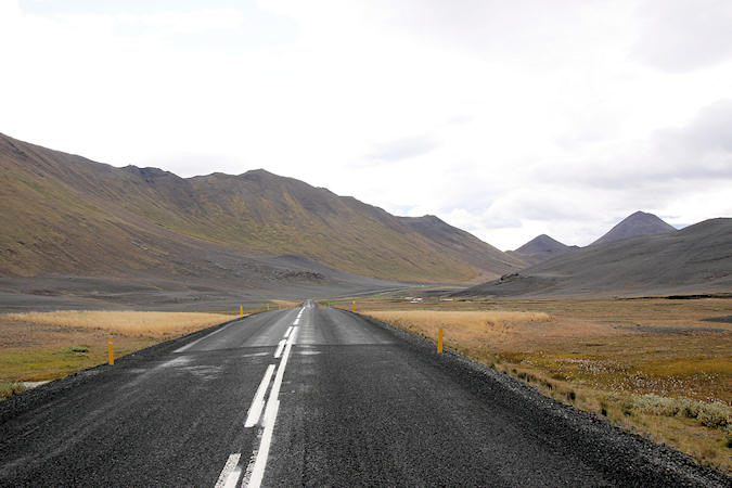
Iceland
Things to DO
Jökulsárgljúfur National Park
 |
|||||
For thousands of years, Jökulsá á Fjöllum, one of Iceland’s largest rivers, has continued to flow
from under the glacier Vatnajökull and wound its way through a landscape of diverse aspects for a
distance of about 200 km until merging with the sea in Öxarfjörður bay.
On its long journey, the river has carved numerous channels into the highland bedrock and to the west of
Hólsfjöll it cascades from a tall rocky ledge, forming the huge waterfall Dettifoss, plunging into,
magnificent canyons.
Jokulsargljúfur nature is full of contrasts. Some marshy spots can be found in the Hafragil and
Holmatungur areas. The established birch woods of Asbyrgi are delightful and provide a home to many plant
species and numerous birds, of which Redwings, Redpolls, Wrens and Snipes are common. Ptarmigans, Plovers and
Meadow Pipits are frequently seen in lower-growing vegetation; around lakes and ponds, wetland birds are
common.
 |
|||||
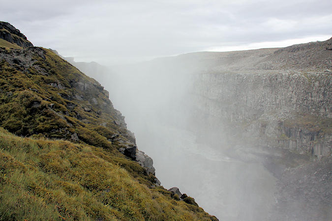
Dettifoss is Iceland’s greatest and most majestic waterfall. It is also rated as Europe’s
most powerful waterfall, based on its magnitude. Dettifoss is 45 metres in height and 100 metres wide and its
force is such that the bedrock trembles when hit by the weight of an immense column of white-foaming water.
The average flow is 193 cubic metres per second but during floods it reaches up to 600 m3/s.
A marked trail leads from Dettifoss up to Selfoss which is also well worth seeing. While only 10m high,
it is very wide. The hike back and forth takes about one hour.
Mt. Herdubreid (1682m) is the prototype of Icelandic table mountains, Its highest peak, facing southeast,
is on the brink of the big crater. The mountain rises 1000-1100 m above the surroundings, its screes are very
steep and lose and above them the mountain is lined with precipitous cliffs all around.
Egilsstaðir
 |
|||||
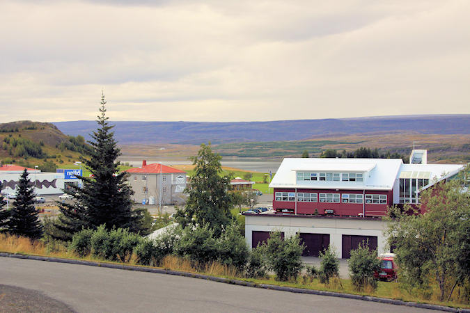
Egilsstaðir itself dates only to the late 1940s, when a supermarket, a vet, a hospital and a
telephone exchange chose to set up shop on a narrow strip of moorland between the glacier-fed Lagarfljöt river
and the back of the East Fjord fells, bringing the first services into this remote corner of the country.
Today Egilsstaðir has grown to fill a couple of dozen streets but remains an unadorned service and supply
centre, important to the regional economy but containing neither a proper town centre nor much in the way of
essential viewing.
Stretching 30km southwest from Egilsstaðir, Lögurinn is a long, narrow lake on the mid-reaches of the
Largarfljót river – which itself originates up in the highlands at Vatnajökull’s northeastern edge.
The Lögurinn is home to the legendary serpent Lagarfljótsormurinn, first mentioned in 1345. It
was considered a bad omen if the curved formes of the monster were spotted above the water. In recent
years it has not revealed itself so often - yet the Lagafljót serpent is truely unpredictable!
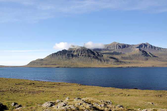
East Coast
The East part of Iceland offers a little bit of everything; majestic mountains and narrow fjords, forests, wide variety of birdlife and bird cliffs and, last but not the least, loads of small fishing villages which hold a special charm.
 |
|||||
At the end of a curving, long, wide and the largest fjord of the eastern fjords rests the village
Reyðarfjörður
Norwegians used to operate whaling stations along the fjord and fishing was frequented along the coastline.
During World War II, Reyðarfjörður was occupied by British forces. The remains of the occupation are fairly
visible, ranging from an airport and old barracks to small gun shelters. In 1995 a War Time Museum was founded
in an empty Freezing Plant and now extends to some of the old barracks. An interesting museum in a country that
was never at war.
Kirkjubær is an old church and is therefore a unique guesthouse in Iceland. Kirkjubær is in
Stöðvarfjorður which is one of the most beautiful towns on the east coast and famous around the world
for Petra's Stone Museum.
Petra Sveinsdóttir (1922-2012) passionately collected stones throughout her life, heading for the
mountains after work on weekdays and spending most her free time looking for new colorful examples of rock.
Her home and garden make up the museum, with innumerable stones filling every shelf, lining every flowerbed
and filling every empty space.
 |
|||||
East Iceland's history is older than the settlement of the Nordic people in Iceland. It's coast is
closest to Europe, and the first visitors from there could have been the Romans looking for the legendary
island of the Greek Pythias "Ultima Thule."
Roman coins dating back to the 1st century AD were found near Djúpivogur.
Djúpivogur, a quiet fishing village at the head of Berufjord has 450 residents and a trading history
reaching back to 1589. It has served as a commercial port since the 16th and survived through the inception
and heyday of the Danish trade monopoly.
Höfn is the second largest town in east corner of Iceland. It's a small fishing town and the main
work available here is related to the fishing industry. Furthermore is Höfn rightly known as the lobster
capital of Iceland, offering visitors a taste of this delicacy!
A lobster festival is held in the town
every year during the first weekend of July.
Vatnajökull National Park
 |
|||||
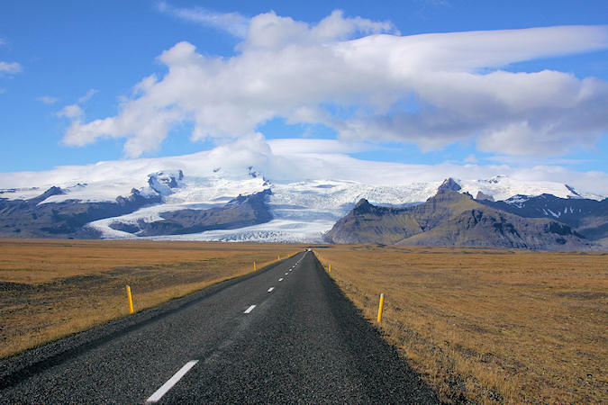
Vatnajökull (2110 m) is the largest glacier in Iceland and it’s also the largest glacier mass
in Europe. It covers an area of roughly 8.200 sq. km and it’s about 1.000 m thick at its thickest point.
Its average thickness is 400 - 500 m
The subglacial landscape is dissected by numerous broad and narrow subglacial valleys and spectacular
canyons.
There are also a number of large active volcanoes under the ice cap including Öræfajökull (2110 m),
Bárðarbunga (2020 m) and Grímsvötn which has the highest eruption frequency of all the volcanoes
in Iceland.
The latest eruption in Grímsvötn was in May 2011 and so far the strongest one for the last 100 years. It began
with 12 km high plumes accompanied with multiple earthquakes and an ash cloud rising up to 20 km.
 |
|||||
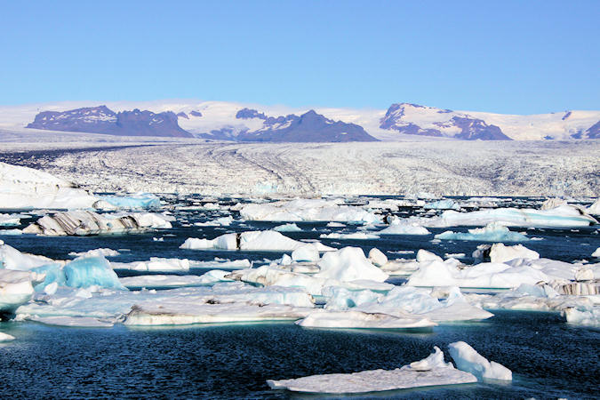
Breiðamerkurjökull, an outlet glacier of the larger glacier of Vatnajökulland, crumbles
down the steep mountainside of the glacier and big icebergs break off into the Jökulsárlón Lagoon where
they float around before melting.
Salmon, Capelin and Herring enter the lagoon and the seals follow, so it's not uncommon to see seals in
the glacier lagoon, resting on top of the icebergs or on the black sand ocean beach.
Plenty of birds also live by the glacier lagoon and the nearby Breidamerkursandur glacial outwash plain is
the main home to the great Skua.
Fjallsárlón is a beautiful glacier lagoon, often passed with little notice. It lies only a few
kilometers from the much more famous Jökulsárlón glacier lagoon. However it is no less beautiful. Just look
for a small sign by the side of the road, shortly before you arrive in Jökulsárlón if headed east.
Skaftafell National Park
 |
|||||
Skaftafell National Park, established in 1967, contains some of the most precious natural pearls
of the country. The area has been shaped by volcanic eruptions, glaciers and lakes, that have created diverse
and unique formations
In the area you can find around 250 types of vascular plants and the nesting places of around 30 different
species of birds. It is therefore safe to say that Skaftafell is the home of luxuriant flora in between sands
and glaciers, where unique natural beauty is to be found.
The area is renowned for its good weather and beautiful scenery which can be enjoyed from various walking paths
within the area, that are suitable for all.
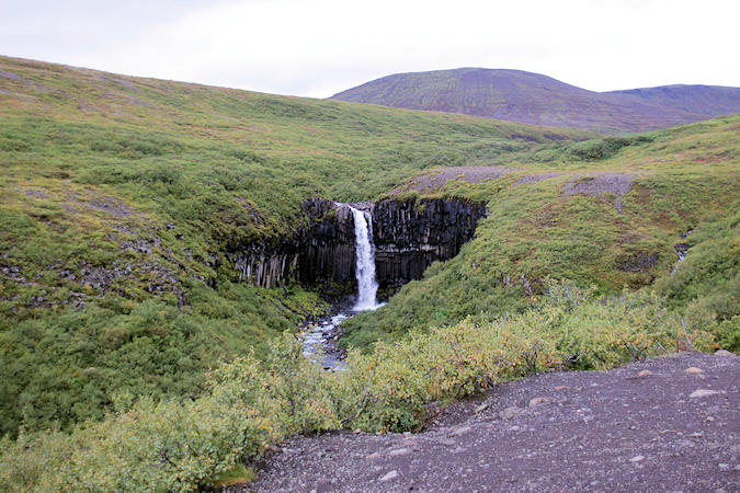
Svartifoss is one of the most popular sights in the park. The name Svartifoss (meaning Black Waterfall)
is obvious, but the black basalt columns that flank the waterfall is less. Arranged in a regular hexagonal
pattern, the rocks hang off the cliff face like organpipes.
 |
|||||
In the Middle Ages there were some large farms in this area, but they were abandoned after
two volcanic eruptions and the ensuing glacier runs.
In earlier times, the farmers had supplemented sheep farming by trips to the coast, where they hunted seals
and collected eggs.
Stranded ships provided excellent material for making various items, and some of the Skaftafell farmers
became well known for their crafting talents. One of them, Sel, was abandoned in 1946 but has since
been restored by the National Museum and made accessible for visitors
The Hofskirkja Church was built in 1884, and was the last turf church built in the old style. It is one
of six churches still standing, which are preserved as historical monuments. The church is maintained by the
National Museum but also serves as a Parish Church.