Ladakh
Things to DO
Kargil - Padum route
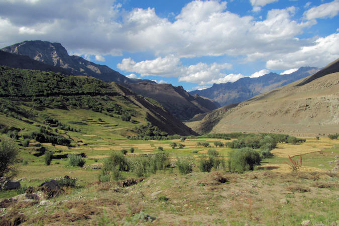
The Kargil - Padum route is a 230 km long stretch that starts from Kargil, travels through the Suru Valley, along the Stod river and ends at Padum in the Zanskar Valley. The lower part of the Suru Valley, at altitudes around 3.000 metres, is one of the most agriculturally productive parts of Ladakh with two crops a year being harvested, watered by the run-off from the very heavy winter snowfalls, and even plantations of willow and poplar trees making it a relatively lush and very attractive area.
 |
|||||
The valley's most significant town is Sankoo (42 km south of Kargil) with a small bazaar.
About 6 km north of Sankoo is a place known as Byama Khumbu where a statue of six armed Avalokiteśvara is seated on a
decorated throne and flanked by two goddesses. There is a two–line Tibaten inscription on the rock. As is the rule with Tibetan-style
rock-carvings, this sculpture is in low relief. It's dated around 7th century AD.
About 4,5 km south-east of Sankoo, the famous 10 m tall Kartse Chamba can be seen, holding a sacred vase water pot in his left
hand and the right hand on his heart gesturing the "protection from all fears of cyclic existences".
The upper part of the body is ornamented with earrings, necklaces, bands on upper arms and bracelets. This Maitreya is flanked by two
flying goddesses ("apsaras") on both side above the shoulder and is dated around 7th – 8th century AD.
 |
|||||
The small village of Tongul marks the exit of the fertile lower Suru valley and the entrance of the upper Suru valley which
is quite flat but the bad roads will still keep your speed severely limited. There will hardly be any greenery around and the Suru
river will run slow with no rapid or waterfalls anywhere. You will continue traveling right next to the river until Rangdum.
About 10 kilometers after the village, you will get views of Parkachik glacier, a mass of ice moving slowly down the Nun-Kun
slopes and finally falls into the Suru River.
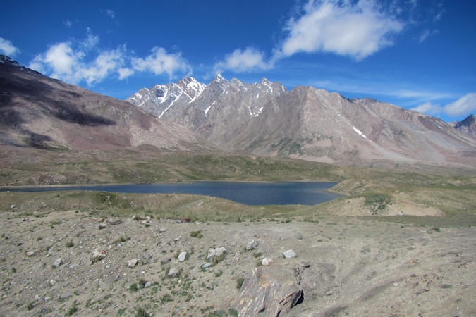
The Kun Peak is the second highest summit of the Nun Kun mountain massif with elevation of 7.077 metres. The Kun Peak
is located north of Nun Peak 7.135 metres, which is the highest summit of the massif and is separated from it by a snowy plateau
of 4 km in length, in the northeast just at the 2 km of distance rises another peak of the massif known as Pinnacle Peak
6.930 metres.
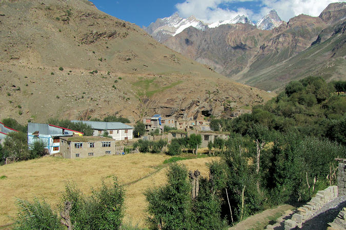
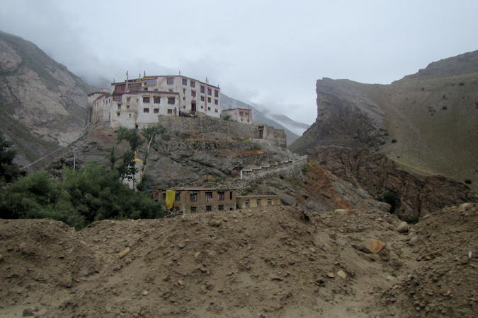
Rangdum, is the last inhabited region in the Suru valley, located about 100 kilometres from Kargil. The population of
the Suru Valley as far as Parkachik are all Muslim. The valley is, however, practically
 |
|||||
uninhabited past Parkachik other than a couple of tiny settlements.
The small villages of Yuldo and Julidok, at the end of the valley, are entirely Buddhist.
The people are socially and culturally part of neighbouring Zanskar and support the 18th-century Rangdum Monastery belonging to
the Gelugpa sect of Tibetan Buddhism.
The Rangdum Gompa was founded in the 18th century and serves as the residence of approximately 40 monks.
The monastery rises over a centrally ascending mound, entrenched around by the route of a mountain stream. The Gompa gives the
appearance of an age-old fortification, which is standing as the protector of a mystical mountain valley.
The Monastery owns the entire valley around it, comprising of the fields tilled by the villagers, the pastures, hills and even the
streams. The villagers staying around the monastery are the descendents of the serf-tenants of the monastery and do not have any
land of their own.
 |
|||||
After about 25 km from Rangdum you reach the Pensi-la, a mountain pass (4.400 metres) which connects the Suru Valley region
to the Zanskar Valley region.
The Drang-Drung Glacier, near the Pensi La mountain pass is likely to be the largest glacier in Ladakh with a maximum length
of 23 km at an average elevation of 4.780 m. and is the source of the Stod River which is a tributary of the Zanskar River.
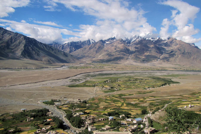
Zanskar Valley is a semi-arid region that is nestled in the lap of the northern flank of Great Himalayas and is only
accessible between the months of June to September, otherwise all the roads to the valley are heavily covered in snow, thus,
blocking access.
Housing a large population of Tibetan Buddhists, the daily life of Zanskar revolves around monks and Buddhist monasteries
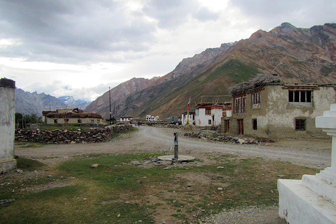
Padum
Once the capital of the ancient kingdom of Zanskar, Padum (3.505 m) is the present day administrative headquarters of the region. It's on the southern part of a wide fertile plain where the Stod river joins the Tsarap river to form the Zanskar river.
 |
|||||
The town is mostly inhabited by people of Tibetan descent but there is also a sizable Muslim minority mainly Balti, who have been
present in Padum since the 17th century.
Padum is named after Padmasambhava (also known as Guru Rinpoche), an tantric Buddhist Vajra master from India who may have
thaught Vajrayāna buddism in Tibet (circa 8th - 9th centuries).
A statue of Padsambhave is located in the middle of a water body, about 5 km north of Padum
Karsha Gompa was founded by the famous translator, Phagspa Sherab in the 11th century. It was constructed on the steep mountain
above Karsha village. The monastery is a complex comprising eight temples, chapels, chortens, residential rooms for 150 monks and
assembly halls.
The monastery consists of a number of shrines and boasts of some of the most exquisite wall paintings, by the Lama Dzadpa Dorje.
 |
|||||
The entire Sani Kani Khar has been built in parts, each dating back to a different century. The chorten inside the oldest
part of Sani Monastery is believed to be erected in the 2nd century AD. On the other hand, the Dukhang (assembly hall) of the monastery
is said to be constructed in the early 17th century.
Adjoining the monastery is a temple dedicated to Mahasiddha Nāropā, who is believed to have meditated here in the 11th century.
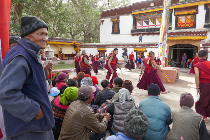
The festival of Sani Naro-Nasjal, is held at the Sani Monastery, usually, in the first week of August. People from all over
the Zankar valley visit the monastry to participate in this two day long festival.
On the occasion, the statue of famed Yogi, Nāropā, is unveiled for the locals and pilgrims to receive blessings. Lamas from the
Bardan monastery perform masked dances as ritual offerings before the idol.
Interestingly, of many monastic festivals, only Sani hosts dances from the newlywed brides of the village. On the culmination of
celebrations, the villagers greet, congratulate and wish the newlyweds with auspicious "khataks" (traditional ceremonial scarves).
 |
|||||
Bardan Gompa, about 12 km south of Padum is built in the shape of a fortress which sits atop a rocky outcrop along
the Tsarap river.
Although its core is from the 13th century, the bulk of the structure was developed in the 16th and 17th centuries by lama
Deva Gyatso, a son of the padum King.
Purne is a small Zanskari village about 42 km south of Padum at the banks of the Tsarap river.
Behind the village are some chortens and a row of stones, called Mani Walls. These mani stones are inscribed with the
"six syllabled mantra" of Avalokiteśvara ("Om mani padme hum""), as a form of prayer.
Buddhist custom dictates that these walls should be passed or circumvented from the left side, the clockwise direction in which
the earth and the universe revolve, according to Buddhist doctrine.