Kyrgyzstan
Things to DO
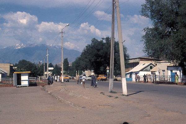
Osh
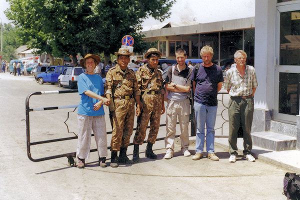
The border crossing between Uzbekistan and Kyrgyzstan at Dostyk is a popular, straightforward border crossing. It’s close to Kyrgyzstan’s second city, Osh, and leads into the Ferghana Valley of Uzbekistan.
 |
|||||
The city is among the oldest settlements in Central Asia. Osh was known as early as the 8th century as a center for silk production
along the Silk Road. The famous trading route crossed Altay Mountains to reach Kashgar to the east.
The Mongols smashed it in the 13th century but in the following centuries it bounched back, more prosperous than ever.
The city was occupied and annexed by the Russian Empire in 1876 when Russia overwhelmed the Central Asian khanates during the
so-called "Great Game", the contest between Britain and Russia for dominance in Central Asia.
This conquest was achieved and the inclusion to the Russian empire made by the mid 1880s, with main credit to General von Kaufman
and General Mikhail Skobelev.
It’s the Soviets that had a big influence on the current architecture of Osh. While the concrete flat appartments are not very inspiring,
the decorative soviet mosaics are.
 |
|||||
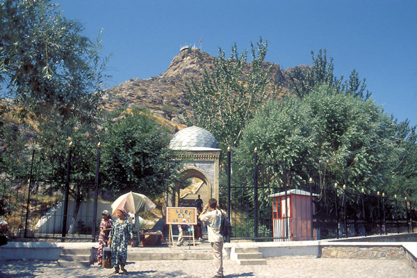
Solomon's Throne, a jagged, barren rock that seems to loom above the city wherever you go, has been a Muslim place of pilgrimage
of some importance for centuries, supposedly because the Prophet Mohammed once prayed here.
From certain perspectives it looks like a reclining pregnant woman and it's especially favoured by women who have been unable to bear
children.
In 1497, 14-year-old Zahiruddin Babur newly crowned king of Fergana (and later to found India's Moghul Dynasty), built himself a
little shelterand private mosque on the rock's high eastern promontry.
The Silver Dome at the base of Solomon's Hill has a few lonely souveniers, including komuz guitars, miniature yurts and the
odd carpet.
The Bazaar streches for about one kilometre along the west side of the river and crosses it in several places. It's most kinetic on
Sunday morning and almost deserted on Monday.
Arslanbob
 |
|||||
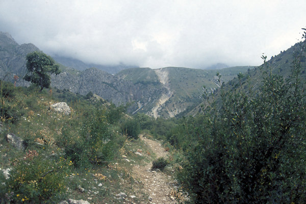
An adventurous do-it-yourself trip goes up to Arslanbob, a totally Uzbek village with a "turbaza" that swarms all summer
with CIS holidaymakers.
Reason to come here are the mountain air, grand setting, abundant fruit, the area's famous walnuts and - for those who can tear themself
away from the turbaza bar and video salon - some fine walking and climbing in the Babash-Ata mountains.
Most day hikes start from the right-hand fork of the main road, just before the turbaza and head up over successive ridges to meadows at
the foot of the mountains.
About 42 km south lies Bazar-Korgon.
The majority of its inhabitants are ethnic Kyrgyzs (approximately 80 percent) and the remaining 20% are predominantly ethnic Uzbek. The
town has a large open air market.
Toktogul
 |
|||||
This town is named for a well-known Kyrgyz "akyn" (improvising poet), Toktogul Satilganov, who was born here in 1884
(died 1933).
It has nothing to recommand it, but the nearby resevoir is a nice place to set up you're camp for a night.
The Toktogul'skaya Ges is part of the Nizhnenarynskiy kaskad, a series of five dams down the lower gorge of the Nayn river.
This cascase, topmost in the series, was completed in 1976 after 14 years'work. More and bigger ones are under construction or in
planning.
Their power is distributed into the grid Kyrgyzstan shares with Uzbekistan and Kazakstan. Hydroelectric power is in fact one of the few
things other than tourism that Kyrgyzstan has to sell to the outside world.
The massive dam, wedged in the canyon, is a pretty awesome feat of Soviet engineering; 210m high, 150m wide at the top and holding back
a 19 billion cubic metre lake.
Kyzyl Oy
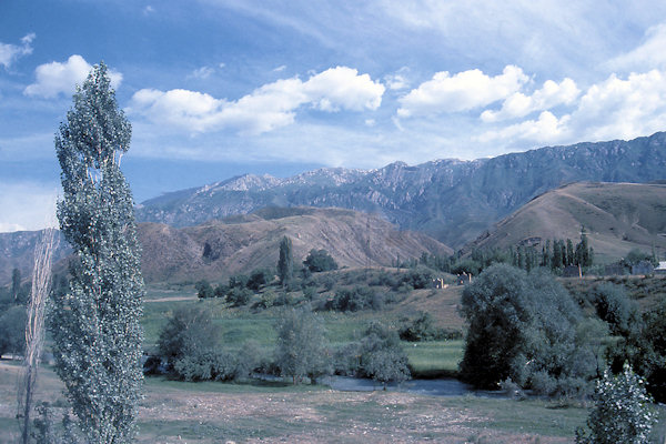
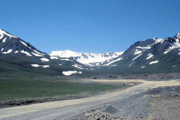
Starting at about 1.000m the road climbes up to the 3.184m summit of the Ala-Bel Pass which leads to the Suusamyr valley.
With its towering mountains, its agitated rivers and vast plains, this valley is popular among nomads for its large pastures, and among
travelers for the peaceful atmosphere and the relaxing hikes it offers. In summer, you will cross numerous herds of sheep or horses, as
well as some yurt camps.
 |
|||||
You can stop by and buy some fresh dairy products such as "kurut" (salted goat cheese) or "Kymyz" (fermented mare milk)
and try local cuisine.
Kojomkul was a seven-and-a-half-foot tall Kyrgyz giant who weighed over 350 pounds and was reportedly able to lift and carry a
full-grown horse. In another demonstration of his incredible strength, he reputedly once lifted a 1,500-pound boulder.
Born in 1889 in a small village called Suusamyr, he became a sensation of his time by winning each and every wrestling and strength
competition along the Silk Road.
At the outskirts of Kojomkul village (about 23 km north of Kyzyl Oy) is an unusual monument dedicated to the memory of Kojomkul the hero.
It consists of a mud building in the shape of a yurt covered by a rickety wooden shelter.
Kyzyl Oy is a small village in the heart of the Kekemeren canyon, with red rocks landscape. A nice place to set op a camp.
Song Kul
 |
|||||
Chayek is a small one-way village along the Jumgal River. There is not much to see, but it still holds a Lenin statue keeping
the soviet-days alive.
As nomadic people until well into the 20th century, the Kyrgyz used to be buried without fuss wherever they died.
However, when this nomadic lifestyle was forcibly abandoned during the Soviet period the erection of large memorials to the dead started
to become fashionable with the newly sedentary Kyrgyz.
In Kyrgyz graveyards disparate traditions – shamanistic, Islamic, communist – intermingle freely. Gently crumbling as their
mud-brick mausoleums slowly decay back into the earth, such cemeteries can be seen along the roadside near Chayek.
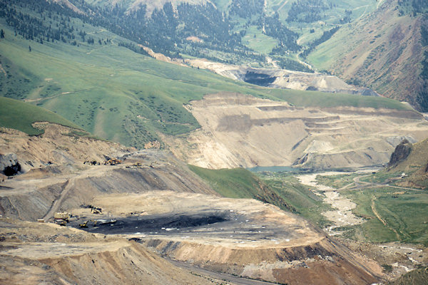
After Chayek the road enters the Karakeche canyon.
It is the site of five open cast coal mines, source of around half of Kyrgyzstan's national coal production
The Kara-Keche mines were developed during the Soviet era, with first production in 1985.
 |
|||||
Then the road winds up again reaching the Kara-Keche Pass at 3.384m leading to the Son-Kul Lake.
Son-Kul is one of the most famous alpine lakes and mountain meadows in Kyrgyzstan. At an altitude of 3.016 m above sea level, Son-Kul is
a startlingly blue lake surrounded by wide, fertile meadows that have long been used by nomadic herders for their animals.
Son-Kul is only accessible in the summer (from roughly June to early September), since snow and ice block the road for the rest of the
year.
There are a number of yurt camps where visitors can stay for a taste of traditional nomadic culture, and the surrounding mountains are
great for horseback rides or treks.
In the winter, temperatures at Son-Kul can reach as low as -20° C, and there are roughly 200 days of snow a year.
During this time, shepherds stay in nearby cities like Kochkor, At-Bashi, and Naryn, where there are more protected spaces for herds
to stay during the long winter.