Kyrgyzstan
Things to DO
Bokonbayevo
 |
|||||
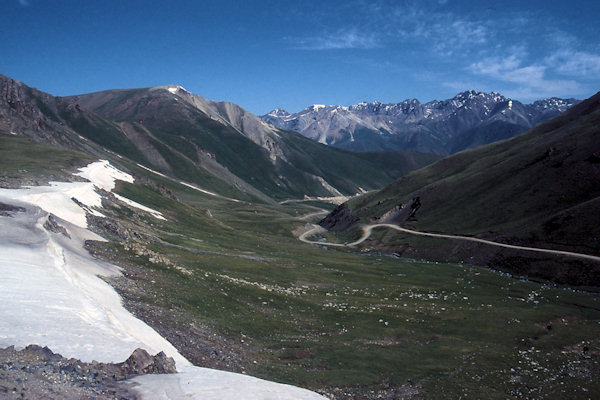
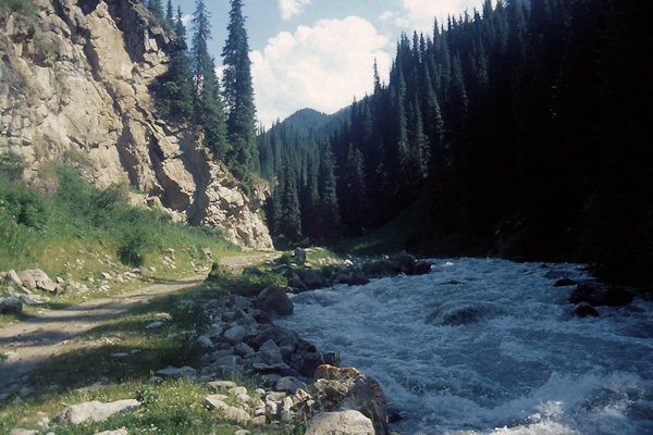
Leaving Song-Kul lake at the east side means passing Kalmak-Ashuu Pass at an altitude of 3.447m.
Ironically the name means "the path is open" but it's only opened from June to October, in the summer-autun period.
Bokonbayevo is a picturesque village on the south shore of Lake Issyk-Kul.
Located in the middle between the Terskey Ala-Too Mountains and the shore of Issyk-Kul, Bokonbayevo draws in visitors with its combination
of natural beauty and traditional Kyrgyz character. Bokonbayevo has even become a center of eco-tourism, promoting tourism in harmony with
the town’s natural surroundings.
The town is also far from the crowded beaches of the north shore, but there are still sandy beaches and warm water for those who enjoy
swimming or relaxing near the water.
Karakol
 |
|||||
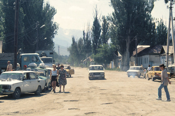
Karakol is a peaceful, low-rise town with backstreets full of Russian gingerbread cottages, shaded by rows of huge white
poplars. Around the town are apple orchards for which the area is famous.
It was founded in 1869 as a Russian garrison, and grew rapidly as explorers passed through the town on their way deeper into the Tian
Shan.
Nearby Issyk Kul Lake was used by the Soviet military as a testing site for torpedo propulsion and guidance systems and Karakol was thus
home to a sizable population of military personnel and their families.
It's not quite paradise for those who live here- the economic stresses of independence and the decline in spa tourism have led to
considerable hardship, thinned out avaiable goods and services and returned a kind of frontier atmosphere to this old boundery post - but
hardly anybody talks about leaving.
For better or worse Karakol looks like headquaters for a new wave of tourism, from overseas.
 |
|||||
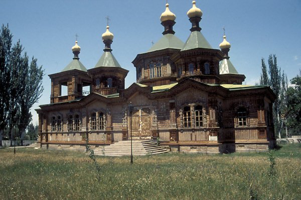
The first church in Karakol was built when the city was founded, in 1869. Its purpose was to serve the troops stationed in Karakol,
which it did until it was destroyed in an earthquake in 1889.
A new wooden church was built on the same spot over the course of six years, and was consecrated in 1895. Upon its completion, the spire
of the new Holy Trinity Church was the tallest building in Karakol, at
26 m tall.
The church was active until 1917, when it became property of the state, and was used as everything from a theater to warehouse. In 1947, the
church started holding services again, but in the 1960s was again used for other purposes.
After independence in 1991, the building was returned to church authorities, who started repairs and reconstructions for the damaged
interior and exterior.
Today, the church is one of the more famous sights in Karakol, and is well worth visiting for its unique architecture and icons.
 |
|||||
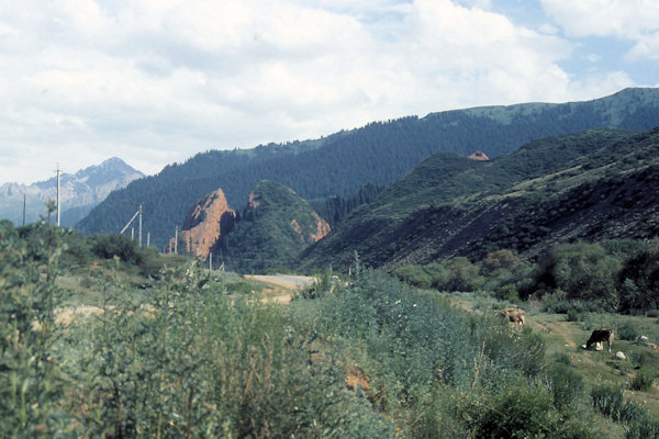
About 25 km west of Karakol, at the mouth of the Jeti-Öghüz canyon, is an extraordinary formation of red sandstone cliffs.
Just beyond the village there is a great splintered hill called Razbitoye Serdtse ("Broken Hard"). Legend says two suitors
spilled there blood in a fight for a beautiful woman, both died and this rock is her broken heart.
Beyond this on the west side of the road is the massive wall of Jetty-Öghüz. The name means "Seven Bulls" and of course there is a
story here too - of seven calves growing big and strong in the valley's rich pastures. Erosion has meant that the bulls have multiplied.
Bellow the wall of Seven Bulls is one of Issyk-Kul's surviving spas the ageing Jeti-Öghüz Sanatorium built in 1932, with a complex
of several hotels a hot pool a restaurant.
From here you can walk up the park-like lower canyon of the Jeti-Öghüz river to popular summer picknic spots.
 |
|||||
Probably the most popular destination about 25 km south-east from Karakol is a spartan hot spring development called
Altyn Arashan ("Golden Spa)", set in a postcard-perfect alpine valley at 3.00m with 4.260m Pik Palatka loomimg at
its southermn end.
Much of the area is a botanical research area called the Arashan state nature reserve.
Altyn Arashan has several small hot-spring developments. In the order that you come to them, they belong to the government meteorological
service, the Teploklyuchenka collective farm and the forestry service.
From Altyn Arashan there are a number of trekking routes, including one across the Karakol, (via the Ala Kul Lake) and Jeti-Öghüz valleys
– but the path can be blocked by snow until summer is well advanced.
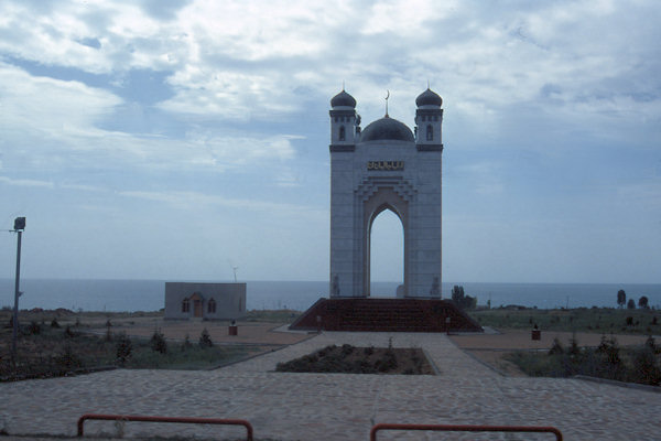
Cholpon-Ata
 |
|||||
Lake Issyk-Kul is basically a huge dent, filled with water in the Alatau ranges that form the northern arm of the Tian Shan.
The name means "warm lake". A combination of extreme depth, termal activity and a mild salinity means the lake never freezes; its
moderating effect on the climate plus abundant rainfall, have made it something of an oasis down through centuries.
About 600m west of the bus station of Cholpon-ata is a turnoff south to a bulge of shoreline.
One kilometer down this road is a tiny boatyard, now known as the Kruiz Yacht club, with a handful of sailboats and launches under repair
or restoration.
South of the boatyard is a small, clean beach with shallow, warm water.
Another much larger public beach lies 2km south of the bus station.
Bishkek
 |
|||||
Bishkek, now the capital and industrial centre of independent Kyrgyzstan is a relaxed and handsome place with wide streets,
Ukrainian-style backstreet houses and mainly good-natured people. There's nothing else old here, and little even predating WWII.
And yet amid the economic malaise the city is attracting a small flow of foreign businesspeople, embassy staff and aid workers as well
as a small but growing Kyrgyz middle class and a network of bars, restaurants and well-stocked shops is sprouting rapidly to support
them.
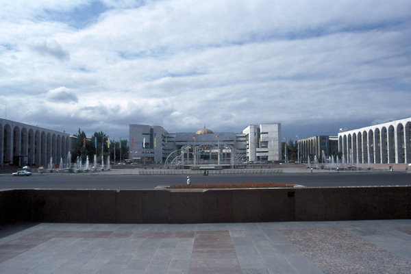
Ala-Too Square is Kyrgyzstan’s main square, located in the center of Bishkek.
At the northern edge of the square is the State Historical Museum, behind which lies Oak Park. A large pedestal holds a statue of
Lenin. Next to Lenin is the official Flagpole of the Kyrgyz Republic.
Some block further on Chuy Ave stand the monument for Martyrs of the Revolution.