Siberia
Things to Do
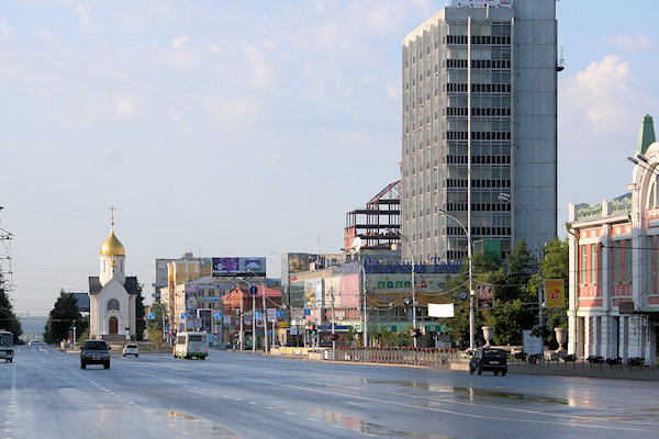
Novosibirsk
 |
|||||
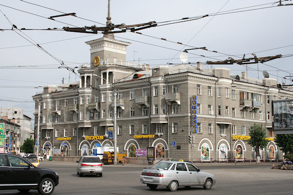
Despite its size (population 1,5 miljoen), the Capital of Siberia" has relatively little to see.
It grew up in the 1890's around the Ob River bridge built for the Trans-Siberian Railway. Since 1925 it
grew rapidly into Siberian's biggest metropolis, a key industrial and transport centre exploiting coalfields
to the east and mineral deposits in the Urals.
Novosibirsk's placa Lenin is dominated by the hudge, silver-domed Opera & Ballet Theatre.
Bigger than Moscow's Bolshoi, its grand interior alone makes performances one of the city's highlights. In
front, wearing a flapping coat, the dashing Lenin Statue is flanked by waving partisans vainly
trying to direct the chaotic traffic.
The pretty little Chapel of St. Nicholas was said to mark the geographical centre of Russia when
built in 1915. Demolished in the 1930's, it was rebuilt in 1993 for Novosibirsk's centenary.
The gold-domed 1914 Cathedral of the Ascension has a wonderful, coulorful interiour with a soaring
central space that's unexpected from its fairly squat exterior appearance.
Biysk
 |
|||||
Friendly Biysk, 300km. southeast of Novosibirsk, is not worth a special detour but its modest
attractions may warrant a brief stop en route to the Altai Mountains.
In 1709, a group of 70 Russian soldiers with five cannons built a fort at the junction of the Biya and
Katun Rivers. This didn't impress the Dzhungarian Mongols, who sent 3.000 men to burn it down.
Biysk was re-established 20km to the east in 1718, and after the peace of 1756 was rapidly developed as a
prosperous trade entrepôt protected by a big, Vauban-style star-shaped fortress (now completely
disappered).
Instead at the north-side of the city, the Russian-army still have a "stronghold"
In the north-part of the city, you can find an exelent museum, housed in a grand if dilapidated 1912
merchant's house with its original Art Noveau fittings.
Further east, wobbly wooden homes and a few maudlin mansions hint a long-past wealth and when you walk
down towards the riverbank, there are several 1890's brick edifices and the silver-domed
Assumption Church.
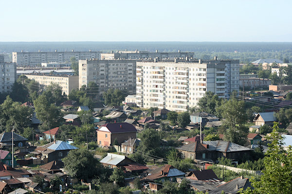
Gorno-Altaisk
 |
|||||
Gorno-Altaisk, the capital of the Altai Republic, is a narrow ribbon of Soviet concrete
blandness scarring an otherwise attractive valley.
Before heading elsewhere in the Altai Republic you should register your visa at the MVD Office.
(situated about 500m east of the market). Importantly you'll need a khodatayatsvo - a letter from
whoever sponsered your visa, listing where in Altai you'll be visiting. With the letter, registration takes
only 15 minutes assuming you can figure out the Russian forms. If you list Aktash or Kosg-Agach as
destinations the necessary border-zone permits are automatically issued.
A moustachioed kameny baba (standing stone idol), welcomes visitors to the interesting museum.
There's a reconstruction of a 2.000-year-old Pazyryk grave pit and some intriguing archaeological finds
from Turkic and Dzhungarian periods. Much of the top floor is a gallery featuring local landscapes by
celebrated Altai artist Grigory Churos-Gurkin (1870-1937).
Near the MVD-office there is a small but attractive Wooden Church.
Lake Teletskoye
 |
|||||
Deep, delightful Lake Teletskoye is Altai's serene answer to Lake Baikal, a great place to
simply relax and cath your breath. The lake is nearly 80 kilometers long by 5 kilometers wide and 325 meters
deep.
Ridge after forested ridge unfolds as you scuttle along omn one of the myriad little pleasure boats that
buzz of Artybach village, the lake's charming tourist hub.
The boats can bring you to the Korbu Waterfall. The falls are hardly memorable but the journey is
very beautiful.
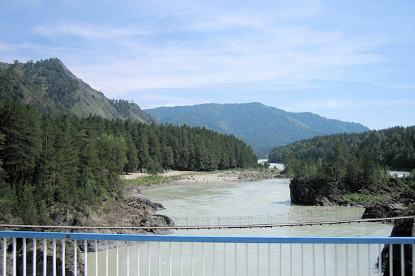
Chuysky Trakt
South of Gorno-Altaisk, the dramatic M52-road to Olgii in Mongolia is known as the Chusky
Trakt.
It offers about 450km of forested mountains, canyons and glimpsed visitas; emerging eventually into
peak-rimmed steppe dotted with Kazakh yurts. The views are arguably better driving northbound as the woodlands are
less dense on the southfacing slopes, leaving visible the photogenic rock cliffs.
Transport is incredibly limited but shared taxis run all the way to Kosh-Agach and drivers are
generelly happy enough to make brief stops en route for photos of landscape, stone idols and petroglyphs.
Gorno-Altaisk - Onguday
 |
|||||
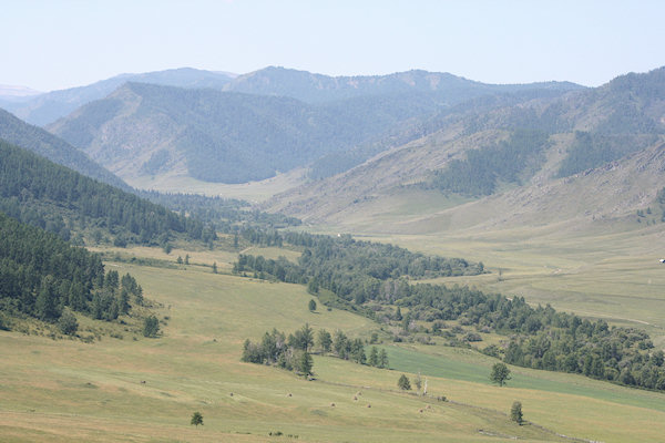
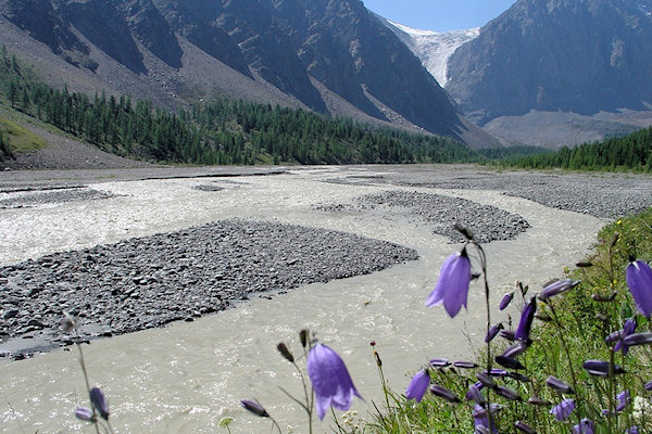
Between Gorno-Altaisk and Onguday the rock dotted Katun River weaves prettily through forest
and between tall grey cliffs.
Villages all along the route have a range of accommodation from basic summer huts to swanky new
hotel-style complexes.
Most people simply come to unwind but between all those vodka-drinking session with holidaying Siberians
you can usually arrange easy rafting trips.
High but relatively unspectacular, the Seminsky Pass (1.715m) topped with a winter sports training
centre and some snack kiosks from which the road decents to Onguday.
Onguday - Aktash
 |
|||||
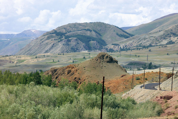
Southeast of Onguday the Chuysky Trakt crosses the beautiful, serpentine Chike-Taman Pass
(1.460m).
Yust beyond Inya village an unsightly pylon, picnic tabels and prayer flags tempt you to stop for
wonderful views of the meeting Ilgumen and Katun River far below.
Meeting a sunset in this aerea gives spectacular vieuws.
Aktash, a nondescript little garrison-village commands a dramatic area of craggy valleys.
Aktash - Kosh-Agach
 |
|||||
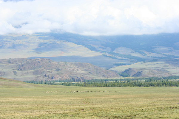
Clouds allowing, the best vieuws on the whole Chusky Trakt are between Aktash and Kosh-Agach.
Wide if distant panoramas of perennially snow-topped peaks rise formidably behind valleys.
These valleys are interspersed by more great cannyons and a colourful mountainside that looks like marbled
chocolate pudding.
Kosh-Agach itself has a strange, end-of-the-world feeling about it, with its shanty-town homes
petering out into magical flat steppe.
When the dusty air clears, the nearby mountains appear from nowhere like apparitions.
A useful landmark is the little wooden Khazret Osman Mosque.
Kurgany and Petroglyphs
 |
|||||
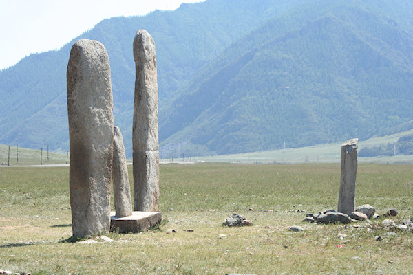
Kurgany are ancient domed burial mounds. Some are over 2.500 yeras old. A faceless trio stand
right beside the Chuysky Trakt just beyond the southern end of Inya village.
Much more interesting are Kament Baba figures, literally "Stone Granddads". The best were
carved in human form holding a cup that symbolically housed the soul of the dead. Just a few Kameny
Baba have avoided being carted off to museums. The most accessible, if not the finest, is at the steppe
near Kosh-Agach.
There are also may groups of animal-shaped Petroglyphs (rock drawing). These may be fascinating but
most are so faint that you might miss the scratches even when you're staring right at them. The best ones
are at Kalbak Tash (about 25km north of Aktash).
Chuyskaya Steppe
Camping spot
 |
|||||
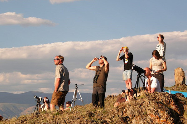
The main purpose of my Altai-trip in 2008 was the solar-eclipse on 1st august.
It could be seen at the far out-post spot on the Chuyskaya Steppe, about 75km southwest of Aktash.
The vally houses diverent Yurt-camps from the Kazakh herdsmen. Most Kazakhs live in adobe houses in villages
in the valleys in the winter. and migrate to mountain pastures in the summer.
Our camping-spot was near a mountain-ridge beside a small river, overlooking the snowy-peaks of the
Altai-mountains.
The Russian-crew set up a cooking-tent and even a Banya near the river.
At daytime the temperatures where okay; though, at an altitude of about 2.050m, is was getting cold at night.
Trekking at the At-Typy glacier
 |
|||||
On the second day we made up for a long trekking (28 km, elevation 1.150 m), that takes about 10 hours.
The first 3 hours where fairly easy to walk, till we reach a kind of base-camp. Here there where
some houses, and a couple of guys relaxing after climbing up the glacier.
As the Russians adore statue's, in the middel of no-where a Walking Lady risses.
After that the slopes were getting steeper and in the end it was just climbing rocks.
The glacier itself was a little messy; wiht lots of sand/stones upon it; but it was a nice few.
Walking down, i realized - as the most off time i was in front of the group - that my bike-traning-excersise
did pay its tribute.
Solar eclips
 |
|||||
THE IMPORTANT DAY ARRIVED. (01-08-2008)
According to our specialist - armed with gps-systems - the spot was about an hour walking eastwards off our
camping-spot. An amateur, as i'm, can only trust them, so on top off a hill we stopped, waiting for the
things to come.
Meanwhile everyone did some tests with the eclipse-glasses and the camera's. For photographing the stadia
before total eclipse, you need special "Home-made filters"
Unfortunatly we missed the firts part of the eclipse, due to the clouds that where comming up. But just
before total-eclipse the clouds moved away, and the full corona was seen beautifully.
For more information about the eclipse; you may take a look at my "somewhat outdated" discription
of The Solar-Eclipse
Last night
 |
|||||
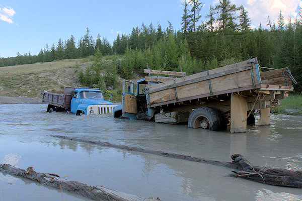
After an exiting day at the eclipse-spot, we headed back to our camping-spot.
Under-way there where some trucks stuck in the river-crosing; but with some help of other trucks they
mannage to get out off the river.
After a nice sun-set, there was a Kazakhian music-player invited, who give a nice performence.
And thus the last evening in the Altai-mountains arrived.
Barnaul
 |
|||||
Barnaul is a prosperous industrial city and has been so almost since its foundation in 1730.
Though far from the mountains, it hosts the nearest major airport to the Altai Republic and offers enough
cafe's and museums to keep you amused between transport connections.
It's from here my Altai-trip ended, and after a stop-over at Moscow, i flew back to Holland.