Sudan
Things to DO
Wadi Halfa
 |
|||||
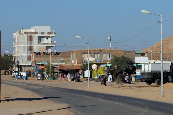
Historically, Wadi Halfa was Nubia's most important trading point, being the gateway between Egypt and Sudan.
Today the city's buildings are immaculate, surrounded by the golden dunes of the Nubian Desert. It is the stereotypical border
town, small and full of paperwork, hassle, and dirt.
The town is actually the new Wadi Halfa; the original Wadi Halfa was submerged when the Aswan High Dam created
Lake Nasser in 1971.
Sudan's military dictatorship forcibly removed the approximately 50.000 inhabitants of the area from their lands and relocated
to the desert, where many died of malaria and other diseases.
A few Wadi Halfans, however, remain along the Nile, the river that built their ancestors' identities as fishermen and river
traders, building new settlements several times and finally settling on the current location when the flooding stopped.
Dessert Railway
 |
|||||
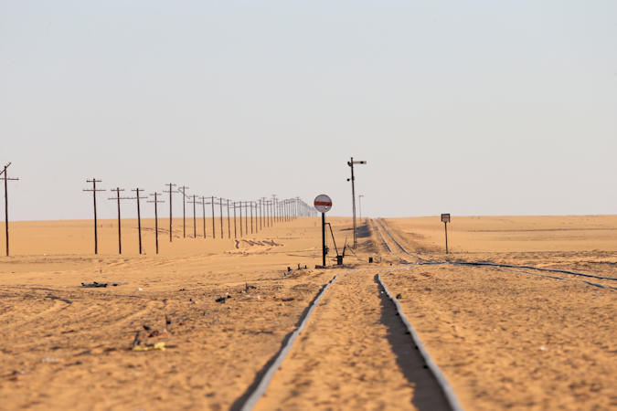
Much more than just two tracks streching to the horizon, this Dessert Railway is one of the great achievements of
Victorian engeneering.
The track was laid as a supply line for the Anglo-Egyptian Conquest of Sudan. Without it, the advancing army was dependent
on camals and carts, or a Nile whose cataracts made navigation difficult and expensive. The train was the key to
Kitchener's campaign.
The challange was considerable. The track had to be laid across 360 km of unsurveyed and watterless desert, advancing into enemy
territory. Furtermore the track was to be laid during the stifling heat of summer.
Kitchener consulted widely with the railway experts of the day, only to find that many dismissed his plan as both crazy and
impossible. He pressed on anyway
Work began in May 1897. Survey teams rode ahead of the working party, who were devided into four teams. The first laid the plates,
the second the sleepers. A third team followed to fix the rails and the final team levelled the line.
The line advanced by an average of 2 km a day, occasionally covering an incredible 5km under the desert sun. A telegraph followed
 |
|||||
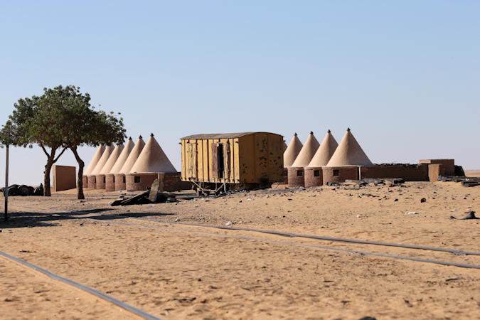
the line and a station with passing sidings was built roughly every
30 km. Water was found at Station 4 en 6 by digging deep wells - the later is still an important stop for today's train
service.
The railway reached Abu-Hamed in oktober 1897, just five months after the first rail was laid. With it, the fate of the
Khalifa was sealed.
Men and munitions were rapidly brought forward in an unstoppable advance. Within six months the Khalifa's army had been smashed
at the Battle of Atabara (April 8, 1898), and the line extended there.
Omdurman fell in september 1898 and the railway was finaly brought to the capital.
More than enything else, it was the train that won the war.
The Atbara Railway Museum in former Orthodox Church holds beside this story other interesting train-history of Sudan.
Merowe Dam
 |
|||||
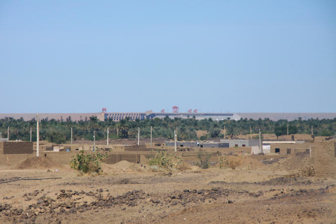
The Merowe Dam in Northern Sudan is one of the world’s most destructive hydropower projects.
Built by Chinese, German and French companies on the Nile’s fourth cataract between 2003 and 2009, the dam created a reservoir with
a length of 174 kilometers. With a capacity of 1.250 megawatts, the project doubled Sudan’s electricity generation.
It also displaced more than 50.000 people from the fertile Nile Valley to arid desert locations. Thousands of people who refused
to leave their homes were flushed out by the rising waters of the reservoir.
Next in line are the Kajbar Dam (third cataract) and Dal Dam (second cataract).
The people from the Kajbar and Dal areas watched the fate of their neighbors in the Nile Valley, where 120.000 Nubian people
were displaced from their ancestral lands in Egypt and Sudan for the construction of the Aswan Dam and expect that the
government would not make any concessions when dealing with Nubians.
Karima
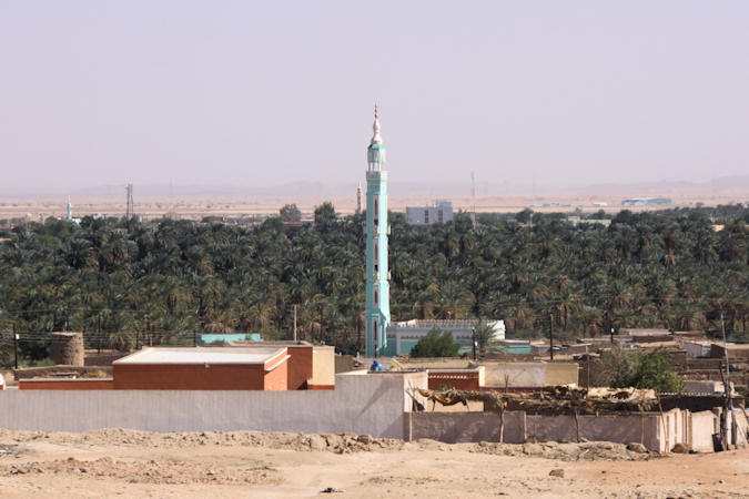
The market town of Karima is the largest town between Atbara and Dongola, but sandwiched between two deserts it seems like a long way from anywhere, with its low buildings and wide dusty lanes. Karima can sometimes give the impression of being the hottest place in Sudan, but stay a while and its lazy rhytms can grow on you. Karima is the place to base yourself to explore the remains of the Napatan kingdom of Kush.
 |
|||||
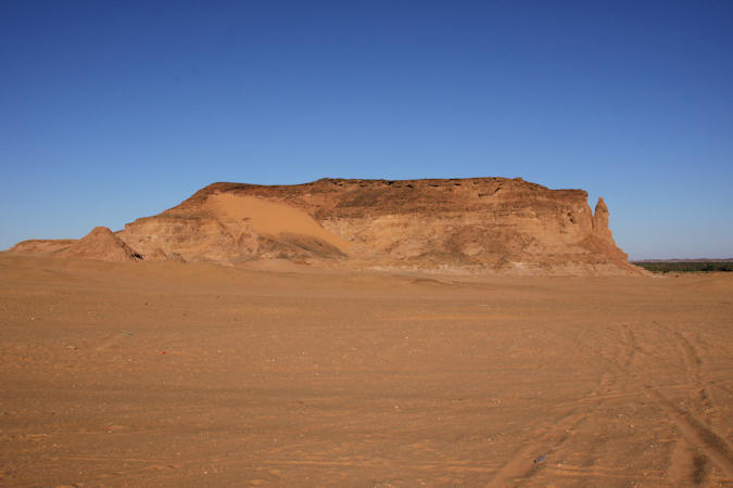
On the edge of town is the incomparable Jebel Barkal, a landmark that dominates the area, with its ruind temples and
perfectly preserved pyramids.
The mountain’s unusual appearance – its isolation, sharp profile, and spire-like pinnacle, 75 m high – made it a natural wonder
in ancient times and excited intense theological speculation.
Jebel Barkal's most distinctive feature is the colossal free-standing Pinnacle on the south corner of its cliff.
This towering monolith, unparalleled in the Nile Valley, was anciently perceived as a gigantic natural statue with many overlapping
identities:
a rearing Uraeus Serpent, a Phallus and, depending on the direction from which it was seen, a vague human
form crowned with a Sun Disk or a White Crown.
Because the uraeus, worn on the front of the the king’s crown, was the primary symbol of Egyptian kingship, and because the
White Crown was the symbol of royal hegemony over Upper Egypt, the pinnacle on Jebel Barkal apparently “proved” to the
Egyptians that the mountain was an original source of their “Upper Egyptian” kingship and that this kingship, granted
by Amun of Jebel Barkal, included all of Kush.
 |
|||||
Thutmose III, one of the first Egyptian kings to penetrate this far south, built the first Temple of Amun in the
15th century BC. Later pharaohs, including Rameses II, expanded it, turning it into an important cultural centre, as well as
a way station for goods from the south destined for the great Temple of Amun at Karnak.
In around 720 BC Piye led his armies north into Egypt and captured Thebes. Ownership of the Temple of Amun gave legitimacy to
his claim to be the true representative of Egyptian traditions; his successors set up the 25th Dynasty and ruled from Thebes and
Memphis as pharaohs. Piye greatly expanded the temple at Jebel Barkal, as did his son, Taharqa.
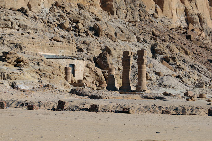
At the immediate base of the pinnacle is the Temple of Mut, dedicated to the Egyptian sky goddes, the bride of Amun.
Also built by Taharqa, the structure is agian much ruined, but the two large collumns with capitals carved in the image of
the goddess Harthor are particularly striking.
Engravings of the temple made in the 1820s show these columns interspersed with others carved in the form of the dwarf god
Bes; these have now disappeared.
 |
|||||
The sanctuary of the temple is actually carved into Jebel Barkal itself, behind a modern metal door. Bes columns hold up the
entrance and the walls are covered in hieroglyphics and relief carvings, many highly worn.
The presence of Bes, a protector of woman in childbirth, and Mut, the divine mother, is intriguing.
The symbolism is pretty overt; a womb-like cave temple sat at the foot of the highly phallic pinnacle of Amun's mountain. Royal
wives possibly came her during pregnancy to give literal meaning to the devine origins of their lineage.
On the western side of Jebel Barkal is a small royal cementery of around 20 Pyramids. This was used briefly by Napatan kings
who had abandoned Nuri at the turn of the 3rd century BC, before the centre of the kingdom was permanently moved south
to Meroë. The reason for this are unknown.
The pyramids are the most intact in Sudan - steep-sided and faced with local sandstone.
El Kurru
 |
|||||
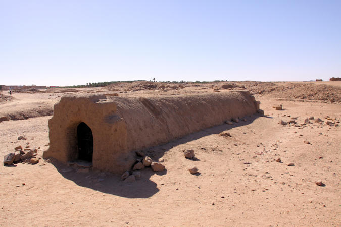
Due to the lack of archeological work in Sudan, only few Kushite Pyramids have actually been dated and explored. The
oldest known Kushite pyramid is dated back to the eighth century BC. This pyramid, located at El Kurru, is identified as
belonging to Pharaoh Piye (747-716 BC).
Most of the grandiose pyramids are built of solid masonry; many were plastered and painted white. Unlike the Egyptian pyramids,
which had their tomb-chambers cut within their pyramid structures, the tomb chamber of the Kushite pyramids were dug under the
ground, below the pyramid structures.
The walls of most of the tomb chambers, were lavishly painted with religious motifs describing the judgment ceremonies of the
deceased in the afterlife. Bodies of the deceased were typically mummified and their organs were placed in canopic jars.
Mummies were placed on extended positions in wooden coffins or on top of beds.
 |
|||||
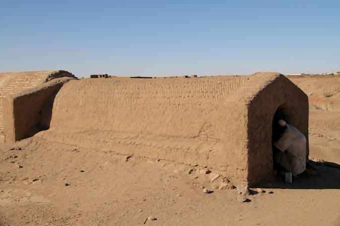
The tomb nearest the entrance gate belong to Tanwetamani, nephew and successor of Taharqa, who died around 653 BC.
Tanwetamani's tomb is empty, but the two plastered chambers are covered in wonderful wall paintings.
The king is painted with dark red skin wearing the Kushite cap with Ureanus (royal cobra), being led to his burial; the
entrence to the inner chamber is flanked by the protective goddesses Isis and Nepthys.
The second tomb is that of Tantwetamani's mother, Qalhata.
If anything, the wall paintings are even better preserved here, with scenes discribing the queens path to the afterlife.
The ceiling is painted with a delicate star field. A plint for the sacophagus is all that remains of the tomb's contents.
Nuri
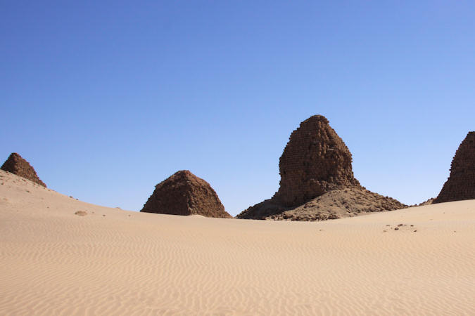
Older than those at Meroë or Jebel Barkal, the pyramids at Nuri are weather-beaten and crumbling; you
can almost see the desert reclaming them before your very eyes. Nuri was adopted as the site of the royal cemeteries in the
early 7th century BC.
 |
|||||
The great Napatan king Taharqa was the first ruler to be buried here, breaking the tradition of interring kings downstream
at El Kurru.
The royal cementery may have been moved here to place it within sight of the religious centre at Jebel Barkal.
Taharqa was proably the most powerful ruler in Sudanese history. He is best known as one of the 25th Dynasty pharaohs of Egypt - the
so-called Nubian Dynasty.
Taharqa's rule extended from the confluence of the Nile to the ports of Phoenicia in modern Lebanon and was part of a renaissance
of Egyptian culture springing from Napata.
Nubia's (and Taharqa's) rise on the international scene was short-lived, coinciding as it did with the expansion of another
regional superpower Assyria. The Assyrians poured out of there heartland and, under king Ashurbanipal, kicked the
Kushites out of Egypt and back up the Nile.
As benifits the grandness of the early period of his rule, Tahrqa's pyramid is the largest at Nuri.