Russian Far East
Things to Do
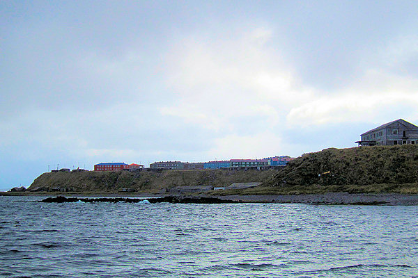
Petropavlovsk - Kamchatsky
Petropavlovsk was founded in 1741 by Vitus Bering the Danish-born Russian captain who discovered the straits
that bear his name. The slowly developing town was named for Bering's two ships, the "Svyatoy Pyotr" (St. Peter) and
"Svyatoy Pavel" (St. Paul); "Kamchatsky" was added to distinguish it from all the other Petropavslovsks.
It became the tsars'major Pacific sea port and was used as the base for explorations that turned up the Aleutian Islands and Alaska.
There were some unlikely visitors in 1779, when Captain Clerke, sailing under the British flag, entered the Petropavlovsk
harbour in command of Captain James Cook's former ships (Cook had lost them, and his life, two years before in Hawaii). Clerke
intended to travel the Arctic, but shortly after setting out was stricken with tuberculosis and died.
In august 1854 more British (with the French in tow) sailed into Avancha Bay with more permanent goals in mind. This seaborn
Crimean War invasion was succesfully and unexpectedly repulsed by the smaller Petropavlovsk garrison.
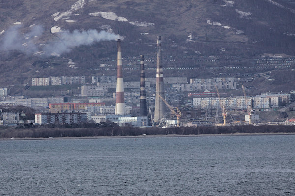
During the Soviet era the town became a sizable Pacific Fleet submarine base, but its present prosperity is owed completely to
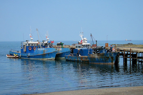
the fishing industry. Rusting Petropavlovsk trawlers bring in a million tonnes of fish a year, of which nearly half is sold to Japan.
 |
|||||
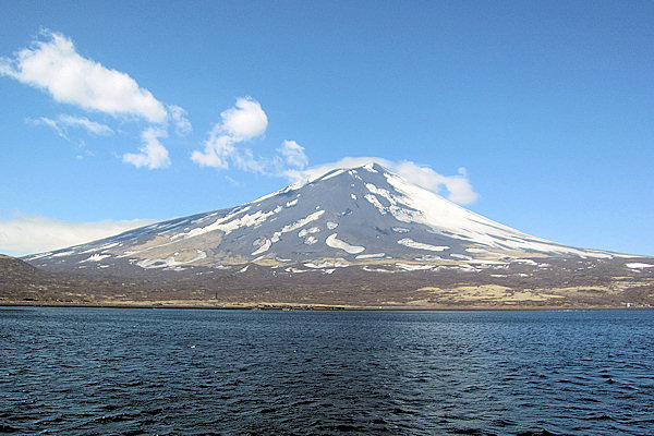
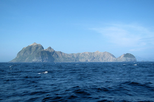
Some see Petropavlovsk as a necessary evil, a hub to Russia's most beautiful scenery, others focus on the setting, one of
the world's most beautiful - facing Avacha Bay and looking out at two giant volcanoes (when the fog behaves) and a long line
of snow-capped mountains.
Though it's one of Russia's oldest towns in the Far East, Petropavlovsk's 25km-long bay is filled with mostly grim Soviet block
housing, but there are enough attractions to warrant a day, and people are quite nice.
The Church of Alexander Nevskiy was originally built in 1857 to commemorate the victory over the British and the French
in the Battle of Petropavlovsk. This wooden chapel was destroyed in 1937 during the antireligious campaigns under Stalin
and was rebuilt in 2007.
Trinity Cathedral: Petropavlovsk's largest and most impressive church is this golden-domed stunner, which sits on
an outcrop from where it is visible from all over the city. Despite looking ancient, the church was built in the early 21st century,
and still isn't complete as funds have dwindled.
 |
|||||
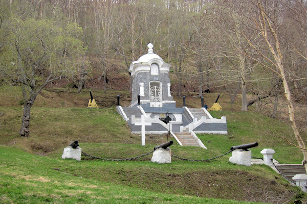
A special place in the memorial of the successful defense of Petropavlovsk port from attack of Anglo-French squadron in 1854
is a small necropolis with a stone chapel on Nikolskaya Hill. It finishes the ensemble with two common graves in its
center. The right one is for Russian warriors, the left one for English and French.
A Monument to French seafarer Jean-Francois de Galaup La Perouse is one the oldest in Petropavlovsk. It reminds about a visit
of this great seafarer in Petropavlovsk Harbor in 1787 on the "Boussole" and "Astrolabe" frigates.
This statue of Saint Nicholas was done by Sergei Isakov, and dedicated in 2008. Because Saint Nicholas is the patron of
all travelers and border guards, the monument is intended to bring the saint’s protection to the city.
Some other attractions in Petropavlovsk include the Lenin Square and the Monument to Peter and Paul.
 |
|||||
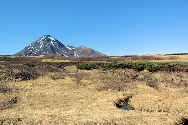
Having federal importance, South Kamchatka Sanctuary is one of Kamchatks’s largest wildlife preserve. It has an
area of 225.000 ha of land and the three mile offshore zone.
It is located in the southern part of Kamchatka peninsula washed by Pacific Ocean in the east and by the Sea of Okhotsk
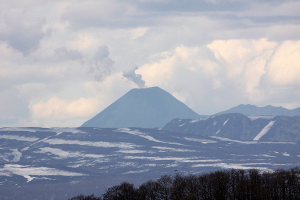
in the west. The sanctuary is crowned by three volcanoes such as Kambalny (2.156 meters), Kosheleva (1.812 meters) and
elegant Ilyinsky stratovolcano (1.578 meters).
There is a well-developed river network, hot springs and many lakes in the sanctuary. Actually all water bodies of the sanctuary
are spawning grounds for Pacific salmon.
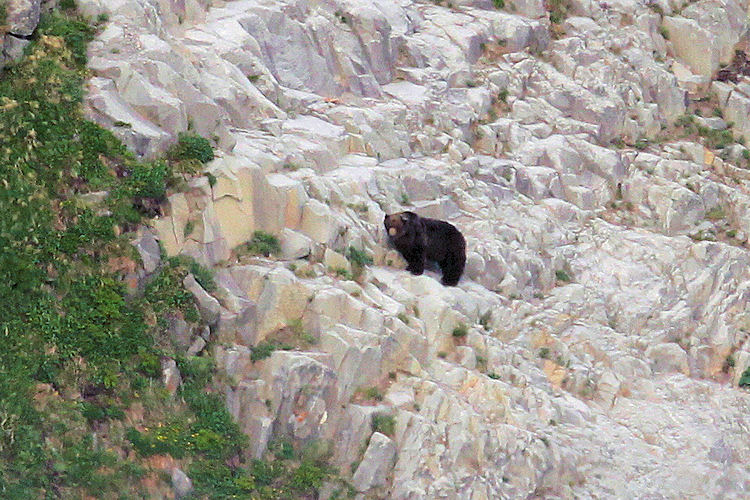
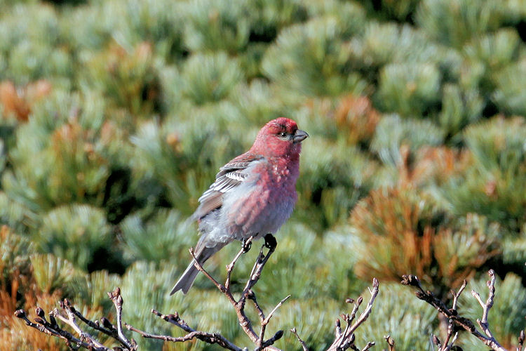
About 10 pair of Steller’s Sea Eagle and one of Kamchatka's largest populations of Brown Bear live within the borders
of the sanctuary.
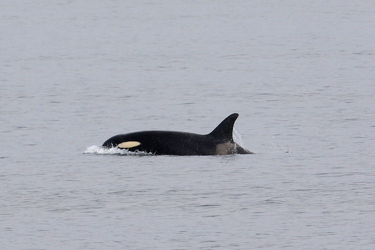
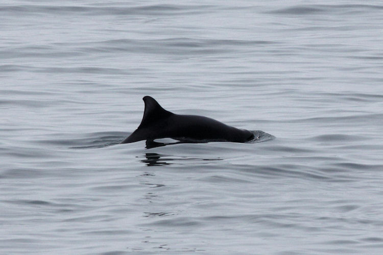
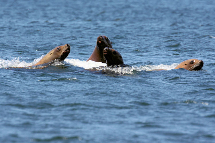
Fin-footed carnivores bed on rocky capes and islands including hundreds of Sea Lions. Sometimes Whales and Dolphins
can be met near the shores of the sanctuary.
Commander Islands
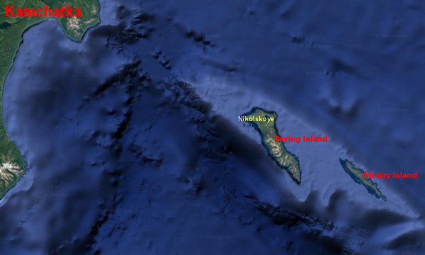
The Commander Islands are a group of treeless, sparsely populated Russian islands in the Bering Sea located about
175 kilometres east of the Kamchatka Peninsula. The islands consist of Bering Island (95 kilometres by 15 kilometres),
Medny Island (55 kilometres by 5 kilometres) and fifteen smaller ones (islets and rocks).
The Commander Islands received their name from Commander Vitus Bering, whose ship St Peter wrecked on the otherwise
uninhabited Bering Island on his return voyage from Alaska in 1741. Bering died on the island along with much of the crew.
His grave is marked by a modest monument.
About half of the crew did manage to survive the winter, thanks in part to the abundance of wildlife (notably the newly
discovered Steller's sea cow) and the efforts of naturalist and physician Georg Wilhelm Steller, who cured many of the
men of scurvy by compelling them to eat seaweed.
Eventually, a smaller boat was built from the remains of the St. Peter and the survivors found their way back to Kamchatka,
heavily laden with valuable sea otter pelts. The discovery of the sea otters sparked the great rush of fur-seeking
"Promyshlenniky" which drove the Russian expansion into Alaska.
Steller's sea cow, whose habitat was apparently restricted to the kelp-beds around Bering Island, was exterminated by 1768.
 |
|||||
Aleut (Unangan) people were transferred to the Commander Islands early in 1825 by the Russian-American Company
from the Aleutians for the seal trade.
Most of the Aleuts inhabiting Bering Island came from Atka Island and those who lived on Medny Island came from Attu
Island, now both American possessions. A mixed language called "Mednyj Aleut", with Aleut roots but Russian verb
inflection, developed among the inhabitants. Today the population of the islands is about 2/3 Russian and 1/3 Aleut.
The only permanently inhabited locality is the village of Nikolskoye on the northwest end of Bering Island, with an
estimated population of 625 people.
There is a local history museum in Nikolskoye settlement with such unique items as a carcass of Steller's sea cow,
guns from the legendary packet boat St Peter being under command by Vitus Bering, samples of Aleutian folk arts and things.
 |
|||||
The Commander Islands are unique for their wildlife of both American and Asian origin. In 1993, the islands were declared a
"zapovednik" (Federal Nature Reserve), and have since been included in UNESCO’s World Network of Biosphere Reserves.
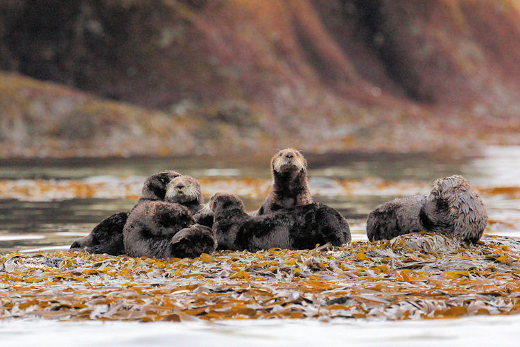
Due to the remoteness from human influence, the area supports an abundance of wildlife. Significant numbers of northern fur seal,
Steller’s sea lion, sea otter and spotted seal are found along the shores, while the surrounding waters are an important habitat
for many whale species. Sperm whale, beaked whale, orca and right whale all feed and migrate here.
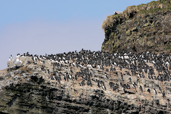
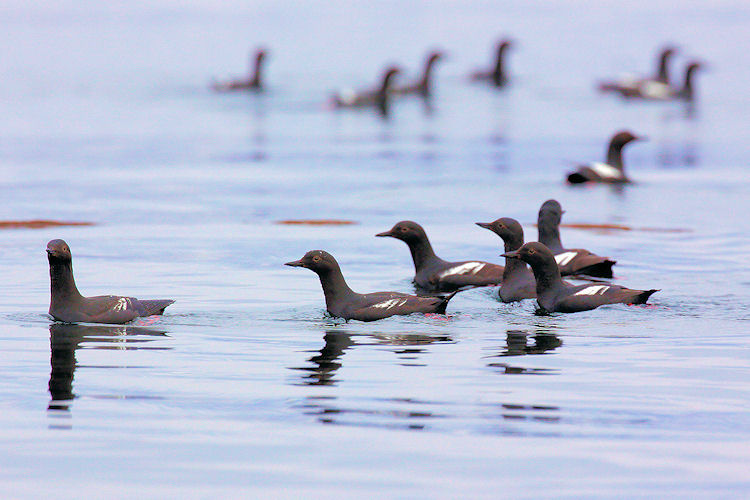
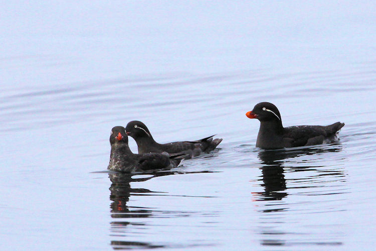
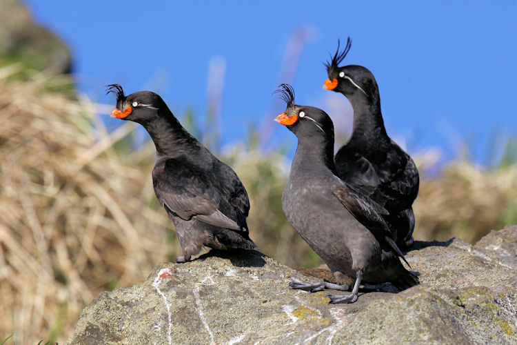
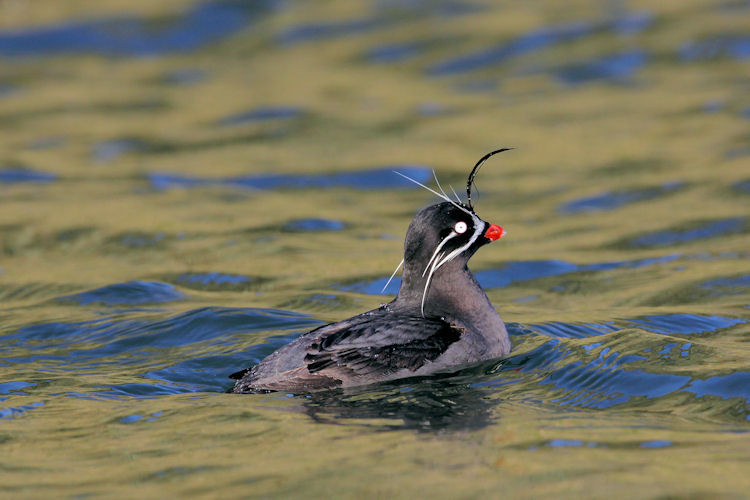
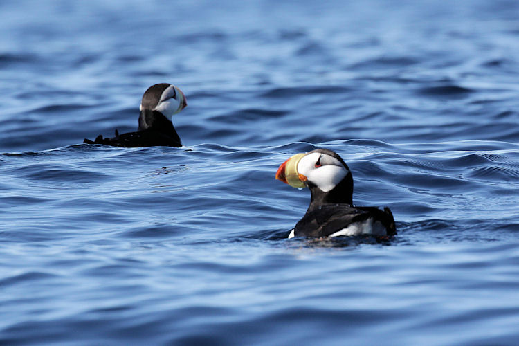
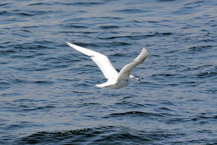
One of the main highlights is the large colonies of seabirds which nest on the coastal cliffs. More than 200 bird species have
been recorded, including the impressive Steller’s sea eagle, while common visitors include Brünnich’s guillemot, horned and
tufted puffin, cormorant and red-legged kittiwake.
Kuril Islands

The stunningly beautiful, rugged 56-island chain of the Kuril Islands are like stepping stones between the southern
tip of Kamchatka and the Japanese island of Hokkaido.
The islands, which form part of the Pacific "Ring of Fire", are actually the tips of a volcanic mountain range. Among the
peaks protruding from the sea are 49 active volcanoes, many of which erupt frequently and violently.
The Ainu people inhabited the Kuril Islands from early times, although few records predate the 17th century. A Dutch
expedition under Maarten Gerritsz Vries explored the islands in 1643. Russian Cossacks landed on Shumshu in 1711.
As a geographic link between Russia and Japan, the Kurils have only been a wedge politically.
The Russian Empire and Japan concluded the Treaty of Commerce, Navigation and Delimitation in 1855, establishing their
border between Iturup and Urup. This treaty confirmed that Japanese territory stretched south from Iturup and Russian territory
stretched north of Urup. Sakhalin remained a place where people from both countries could live.
The Treaty of Saint Petersburg in 1875 resulted in Japan relinquishing all rights over Sakhalin in exchange for Russia
ceding all of the Kuril Islands south of Kamchatka.
But then, in the last days of WWII, the Soviets reneged on the deal and invaded the Kurils. For three years the new Russian
settlers and the existing Japanese residents lived side-by-side, but in 1948 Stalin ordered all the Japanese to leave.
The Kurils have been a diplomatic minefield between the two nations ever since and, technically, Japan and Russia never concluded
a peace treaty after WWII because of them.
About 19.500 people inhabited the Kuril Islands and teh main centra are Severo-Kurilsk on Paramushir, Kurilsk on Iturup,
Yuzhno-Kurilsk on Kunashir and Malokurilskoye on Shikotan.
 |
|||||
Atlasov Island is the northernmost island also the highest volcano (2.339 metres) of the Kuril islands. The island is
named after Vladimir Atlasov, a 17th-century Russian explorer who incorporated the nearby Kamchatka Peninsula into Russia.
Paramushir's name is derived from the Ainu language, from "broad island" or "populous island".
Paramushir is roughly rectangular, and is the second largest of the Kuril Islands with an area of 2.053 square kilometres. Geologically,
Paramushir is a continuous chain of 23 volcanoes. At least five of them are active, and exceed 1.000 m.
Following the dissolution of the Soviet Union in 1990, the population of the island has decreased, and villages that once lined
the coast are now ghost towns. This is due in part to the crash of the formerly lucrative herring fishery, to the extremely
destructive tsunami of 1952, and general economic hardships in the more remote reaches of Russia since the fall of the Soviet Union.
 |
|||||
Onekotan's name is derived from the Ainu language for "large village”. The strong winds and harsh climate limit
the growth of trees to small thickets of Krummholz formations of Siberian dwarf pine.
Makanrushi consists of a dormant or extinct stratovolcano, Pik Mitaka which rises to 1.169 m above sea level.
The island has steep cliff sides and no sandy beaches, making landing very difficult and dangerous even in calm weather.
Ekarma consists of two overlapping stratovolcano, collectively called Pik Ekarma which rises to 1.170 m
above sea level. Lava flows radiate in all directly from the central peak, forming an uneven shoreline.
The last eruption of the mountain was in May 1980, during which ash emissions reaching a height of one kilometer were observed
from a fishing vessel.
 |
|||||
Ushishir consists of two islets connected by a narrow spit of land with an area of 5 km2.
The southern island, Yankicha, consists of the summit caldera which has a diameter of 1.6 kilometres, and is breached
on the south, forming a sea-water crater bay.
Two small lava domes form small islands in the central lagoon, and numerous fumaroles and hot springs are along the southeast
caldera shoreline.
During World War II, the civilian population of Shimushir was evacuated to the Japanese home islands and Simushir was
garrisoned by a detachment from the Imperial Japanese Army. It was surrendered to Soviet forces during the Battle of the
Kuril Islands without resistance.
Under the Soviet Union, Brouton Bay was used by the Soviet Navy as a secret submarine base between 1987 and 1994, and
had a population of approximately 3.000 people. The island is now uninhabited.
 |
|||||
Iturup consists of volcanic massifs and mountain ridges. A series of a dozen calc-alkaline volcanoes running NE to SW form
the backbone of the island, the highest being Stokap (1.634 m) in the central part of Iturup.
There are a lot of mud pools, hot lakes and mineral streams on the island and a the termal complex "Vannochki" (Russian for Bathtubs).
When you approach Kunashir island from the north you can see the
12 meter high Ptichy Waterfall.
Nature:
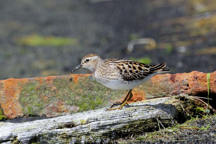
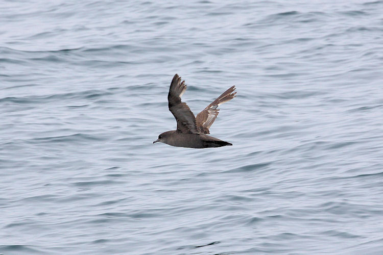
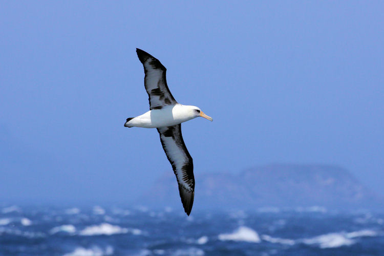
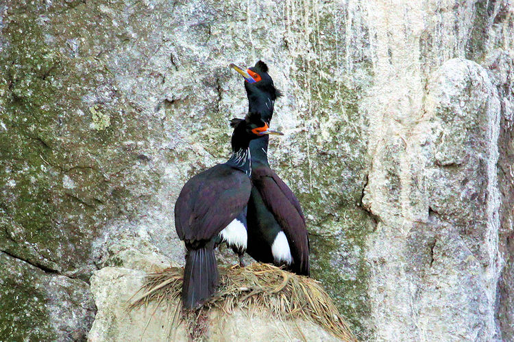
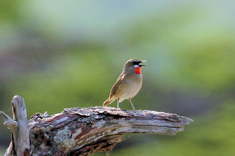
Several of the islands have been recognised as Important Bird Areas (IBAs) by BirdLife International because they support
populations of various threatened bird species, including many waterbirds, seabirds and waders.
These are pictures
of the nature of the Kuril Islands.
Yuzhno-Sakhalinsk
The first Japanese settlers of Sakhalin came across from Hokkaido in the early 1800s, attracted by marine life so rich that
one explorer wrote "the water looked as though it was boiling".
The island already had occupants in form of the Nivkhi, Oroki and Ainu peoples, but, just as this didn't give
pause to the Japanese, the Russians were equally heedless when they claimed Sakhalin in 1853. Japan agreed to recognise Russian
sovereignty in exchange for the rights to the Kuril Islands. In 1882 the tsar made the remote island into one hudge Penal
Colony.
Japan restake its claim, seizing the island during the Russo-Japanese War and getting to keep the southern half, which
the called Karafuto, under the terms of the Treaty of Portsmouth 1905.
 |
|||||
In the final days of WWII, though, the Soviet Union staged a successful invasion of the island. Sakhalin became a highly
militarised eastern outpost of the Soviet empire, loaded with aircraft, missiles and guns.
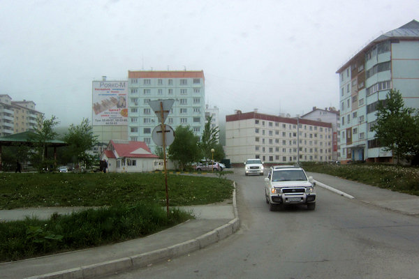
Sprawling between mountains, landlocked Yuzhno-Sakhalinsk is the booming capital of Sakhalin. There is not a lot to
do - that is if you're not in town bound for oil rigs or construction projects - but it's a good (and only) starting point to the
rest of the relatively unexplored island and it offers some flashy restaurants and bars.
The 220-acre Gorodskoy Park, at the city's east side, is Yuzhno's greenest hang-out spot, with loads of rides, shaded
walkways and free concerts in summer.
About 40 km south of Yuzhno-Sakhalinsk is the grimy port of Korsakov, center of the island's hugely profitable fishing industry